
In my last post, I thought I was going to be able to cover Las Vegas, and two National Parks (Zion and Bryce Canyon), but I overpromised. This time, I will just see where my writing takes me, starting with my take on Bryce Canyon ツ.
Bryce Canyon National Park
The drive from Zion to Bryce Canyon is about 2.5-hours long, and we actually managed to stay on track with this timeline, unlike our drive from Las Vegas to Zion. The trick was not to make too many stops between the two destinations (super obvious, I know) – we managed to restrain ourselves and only made one stop at Red Canyon.
Our stop at Red Canyon was very short – it was mostly an opportunity for us to get acquainted with the “hoodoos,” which we would see in abundance once we arrived in Bryce Canyon.

We arrived at our accommodation, which was actually in a small town called Tropic, by late afternoon. Because we were only in the area for one night, we were not particularly picky about where we stayed. However, we were very pleased with our accommodation at Bryce Country Cabins – these log cabins made for an authentic small-town experience, and they were very spacious and clean.
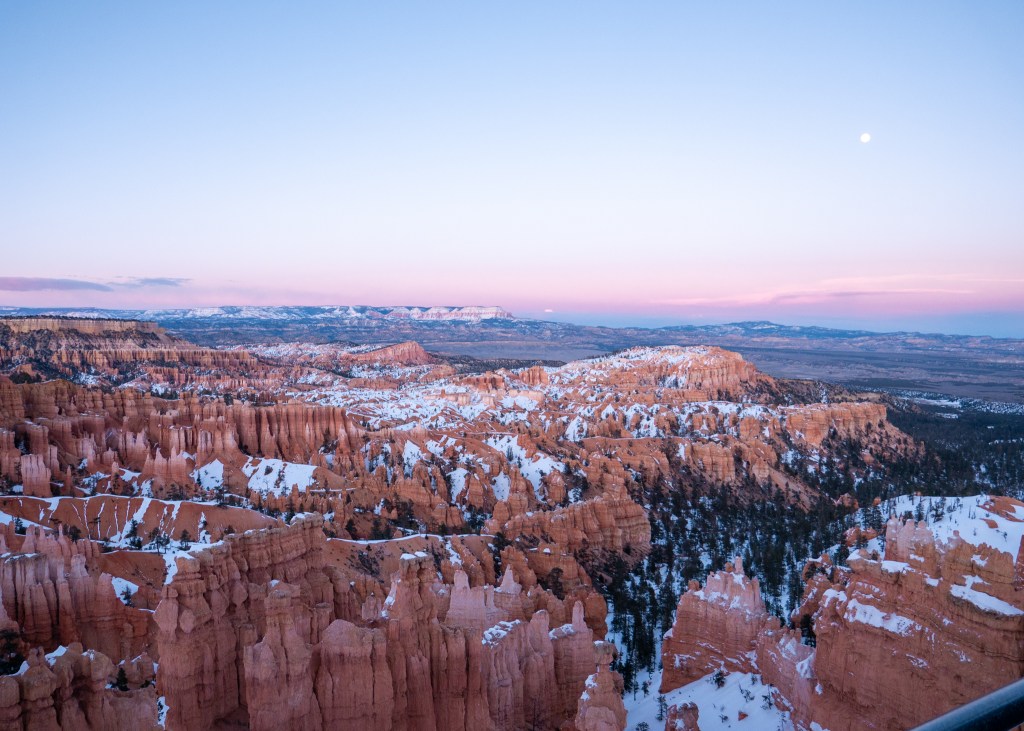
After getting settled, we made our way into the Park to have dinner at Bryce Canyon Lodge before heading to Sunset Point for – you guessed it – the sunset that evening.
Our first evening at Bryce Canyon was incredibly cold, it was around -10°C, and there was also a wind chill. I took a couple pictures of the sun setting on the hoodoos and then quickly made my way back to the vehicle to warm up my hands – my fingers felt like icicles! What made the situation worse was that the next day was going to be even colder – the Weather Network indicated it would be -25°C. For someone who does not tolerate cold very well, I was definitely a bit worried about staying warm during our hike the next morning, so our group started searching for somewhere to buy hand warmers, scarves etc. While the general store in the Park did not have scarves and was sold out of hand warmers (apparently we were not the only ones with this idea), we struck “gold” at a gas station in Tropic near our accommodation. I should have gone back to Bryce Canyon and sold my hand warmers for twice the price!
The next morning, we packed our stuff and I bundled-up in as many layers as I could in preparation for what was expected to be a very cold hike. This actually made packing easier, as I appeared to be wearing most of the clothes I brought! I attempted to wear three pairs of pants… but I could barely move… and opted for two pairs instead.
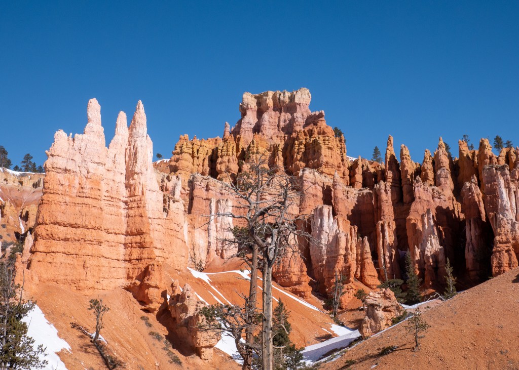
Our initial plan was to do the Navajo Loop and Queens Garden Trail; however, the Navajo Loop portion was closed during out visit, as the trail had been damaged from the snow and ice. But, we were still able to walk down into the hoodoos via the Queens Garden Trail.
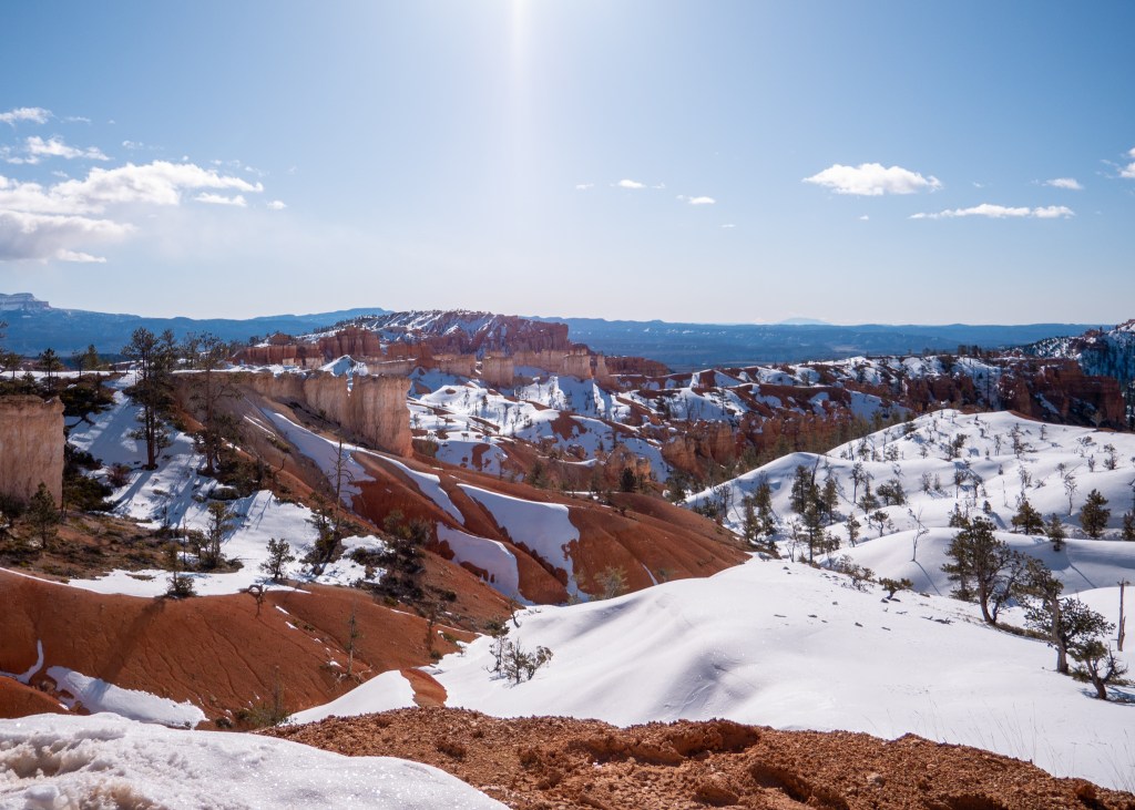
The start of Queens Garden was quite icy, but fortunately, we came prepared with crampons and hiking poles, which made the experience much more pleasant. Our entire group was in awe as we descended into the canyon, surrounded by spire rock formations. I found myself pulling out my camera every few minutes to take photos, and had to be reminded several times that we did not have all day!
Also – it was a lot warmer than we anticipated. While I had activated my hand warmers on the drive into the Park, I did not actually need them. The sun was shining, and there was no wind chill, which made for a perfect hiking experience. Overall, we left Bryce Canyon feeling very grateful for an incredible outdoor experience.
Capitol Reef National Park
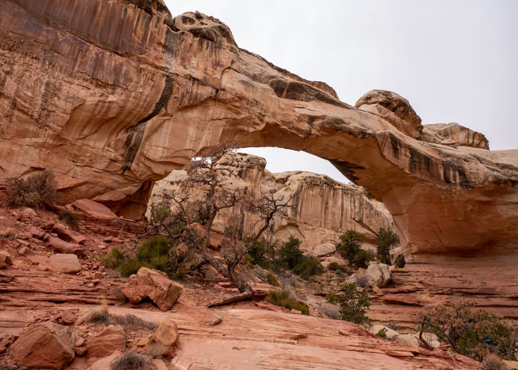
We left Bryce Canyon around lunch time to start driving towards our next Airbnb in Monticello, which was about five hours away. On the way to Monticello, we would be passing through Capitol Reef National Park, and wanted to ensure we completed the top-rated trail in the park: Hickman Bridge.
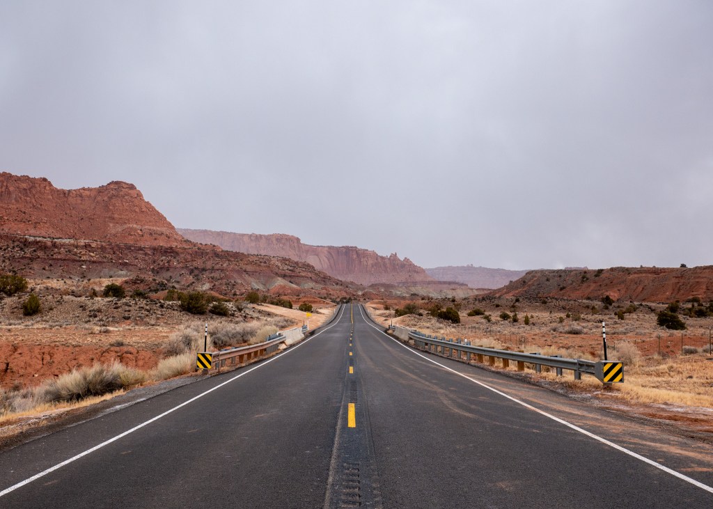
While Justin and I were on our Yukon trip, I made a comment about wanting to get a mountain photo from the middle of the highway while we were driving from Skagway to Whitehorse. However, the road was not straight, and we did not feel that there were any safe opportunities to capture this moment.
But, we were able to make this vision come to life while approaching Capitol Reef National Park. As we were driving down the (straight) highway, we could see the rock formations in the distance, and there was even a pull-off on the side of the road. Justin, Iwona and myself all got out to take photos, while Craig kept an eye out for cars. Iwona and I even attempted to get some photos of us jumping on the road, which was quite the adrenaline rush – this took several attempts, and we had to run off the road a couple of times as vehicles started to approach!
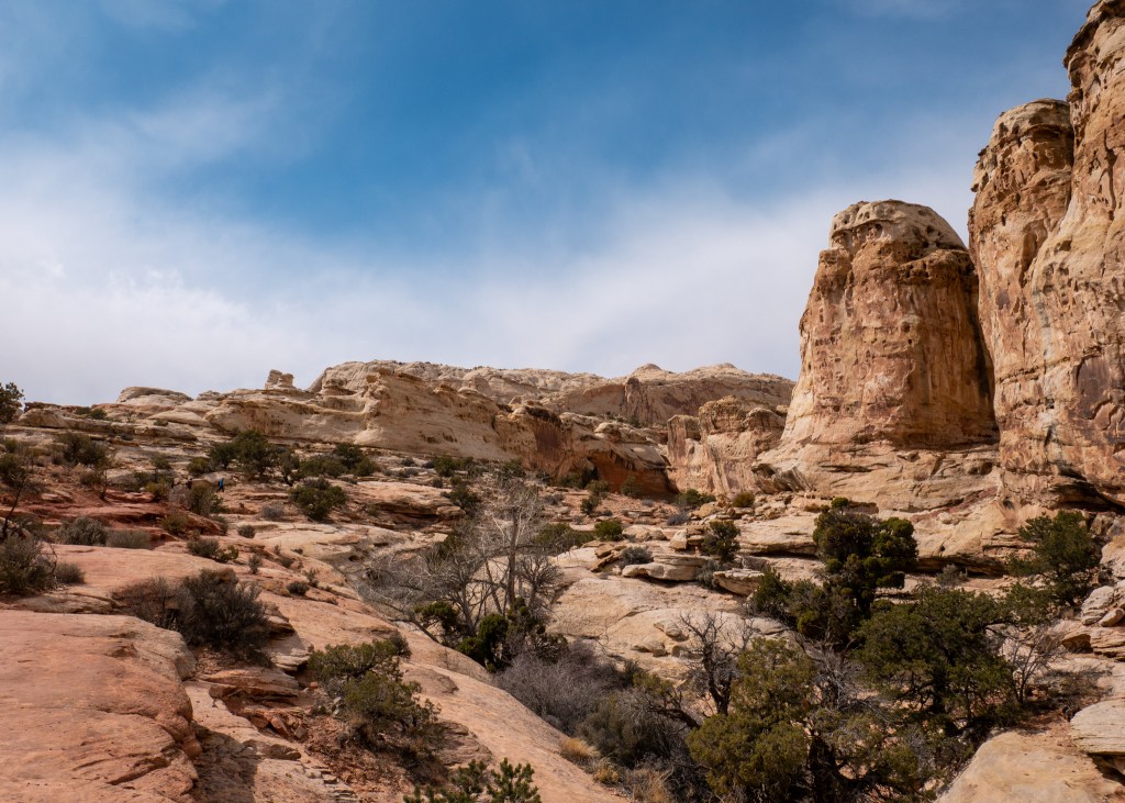
The Hickman Bridge Trail is quite short (a little over 2.5km) and was very busy when we arrived. We very much enjoyed our walk towards the bridge, as we encountered beautiful landscape scenery along the way and were also able to admire a primary Capitol Reef landmark – Pectols Pyramid.
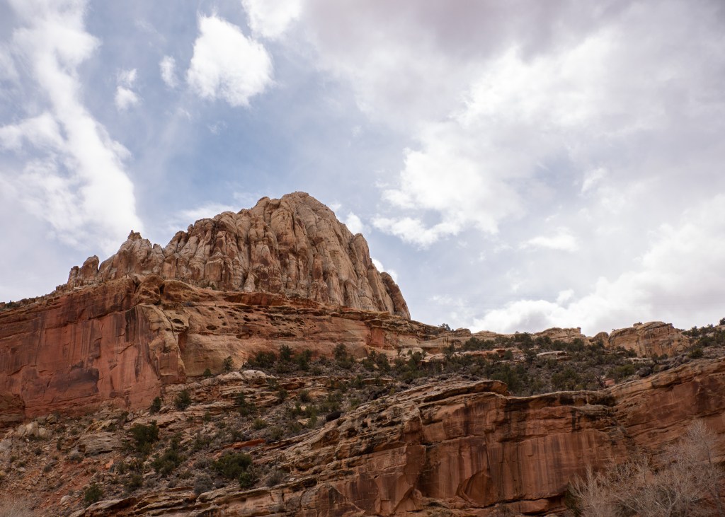
I came up with a theory on our walk that the Park must be named “Capitol Reef” as many of the rock formations had holes that made it look like coral reef… but a quick Google search has proven my assumption to be incorrect. According to the USA National Park Service, the name was chosen as the rock formations in the Park look similar to the Capitol building in Washington, DC. I was close… ツ.
While we barely scratched the surface of what this beautiful park has to offer, I am thankful we were at least able to sneak a preview during our trip, and look forward to doing more exploring here in the future!
Always grateful,
Michelle
