After an eventful journey from Indio to Las Vegas, we ended the evening by watching the Vegas Golden Knights lose 6-0 to The Utah Hockey Club – not exactly the outcome we were hoping for! It was then time for bed, as we were up early the next day to head to the hottest place on Earth: Death Valley National Park.
As you may recall in Part 1 of this blog series, I explained that our primary reason for staying in Las Vegas was because both Death Valley National Park, as well as Grand Canyon West, are within a two-hour drive from Las Vegas. Since we had two full days before heading back home, we dedicated one day to the Park, and the other to Grand Canyon West, including some additional quick stops in Arizona and Nevada.
Day 1: Death Valley National Park:
As noted above, Death Valley National Park is approximately two hours west of Las Vegas. While most of your drive will be through the desert landscape, you will encounter one main city about halfway called Pahrump. We did not spend much time here, with the exception of a quick, impromptu stop when we saw the Pinkbox Doughnuts sign ツ. But in all seriousness, if you need coffee, snacks or gas, you can find all of this in Pahrump.
We made it to Death Valley National Park around 9:30am, making our first stop at the Furnace Creek Visitor Centre to check out the gift shop and pick-up a map of the Park. Note that the Park Ranger will request to see your Park Pass before they provide you with a map!
Death Valley National Park is huge – almost 3.5 million acres – and with only 6 hours of daylight available to us, we had to very selective about the stops we wanted to make. After talking to the Park Ranger and reviewing the map (which does an excellent job of highlighting the most popular stops, especially if you are under a time constraint), we decided to start with a hike through Mosaic Canyon. Described as an “out and back hike within polished marble narrows with unique colour patterns,” Mosaic Canyon did not disappoint! The hike is almost 6.5km long, and took us around 1.5-hours to complete. While I do not recall too much incline during the hike, there are some rock scrambles and narrow passages along the trail to justify the moderate rating on AllTrails.


Following our hike at Mosaic Canyon, we made a quick stop at the Stovepipe Wells General Store before continuing to the Harmony Borax Works site. It is worth noting that the Mesquite Flat Sand Dunes are right near the General Store; however, given that we were pressed for time, and we already saw the Kelso Sand Dunes in the Mojave Dessert, we opted to skip this stop and admire the Mesquite Flat Sand Dunes from a distance.
Our next stop was at the Harmony Borax Works, which is a short walking tour amongst the remains of a borax processing plant. Borax was Death Valley’s most profitable mineral, otherwise referred to as the “White Gold of the Desert.” As per one of the information signs:
“Borates – salt minerals – were deposited in ancient lake beds that uplifted and eroded into the yellow Furnace Creek badlands. Water dissolved the borates and carried them to the Death Valley floor, where they recrystallized as borax.”
Borax was then refined right here in Death Valley – a process that involved separating the crystal from mud and other salts. Unfortunately, Harmony Borax Works was forced to close in 1888 due to economic hardship, as borax was uncovered in other areas of California.

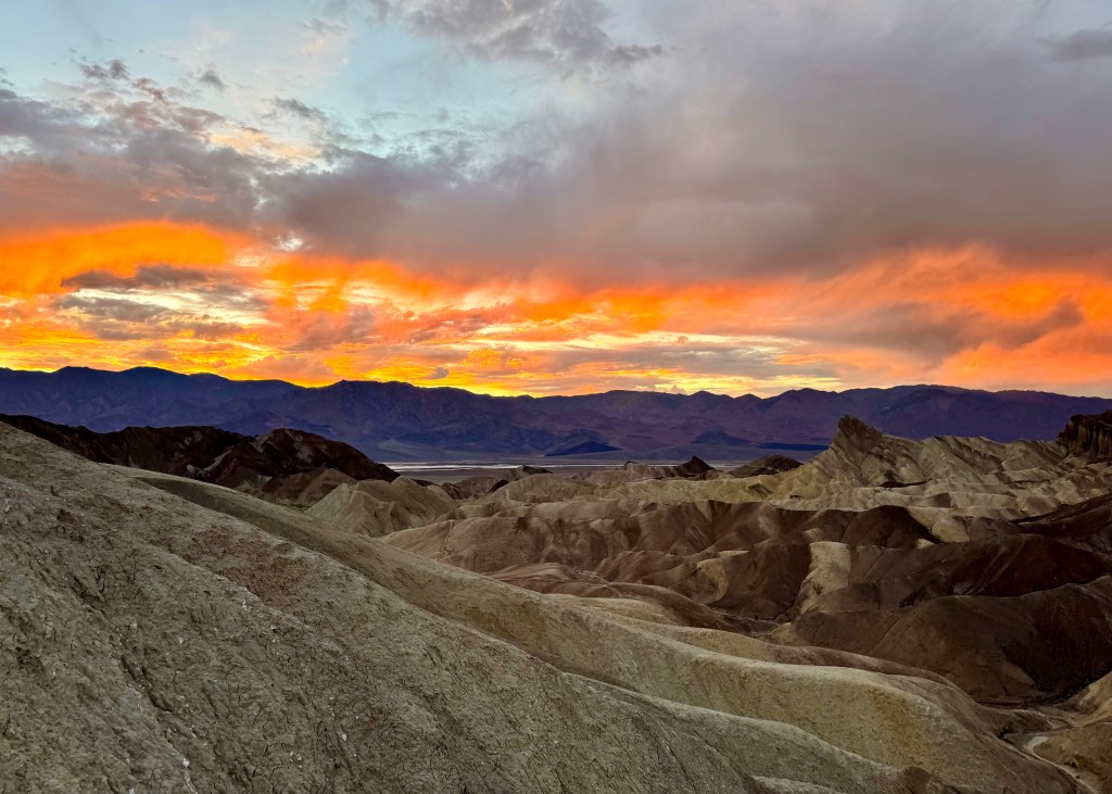
Our next stop was at Zabriskie Point, which provides beautiful landscape views of the Death Valley badlands. Unfortunately for us, a dark raincloud rolled into the area at the same time that we did, which was incredibly distracting (as you can see in the photo below). For this reason, we kept our time at Zabriskie Point brief, and decided we would return here later in the evening to watch the sunset – we were also hoping the rainclouds would disappear by then!

We continued our adventure through Death Valley by stopping at Badwater Basin, which is the stop I was most excited about. Badwater Basin is considered the lowest point in North America – it is 282 ft below sea level. There is actually a sign on one of the surrounding mountains that indicates where sea level begins – it is very surreal. What is even more interesting is that the Badwater Basin trail is actually a 3.1km walk along the salt flats! It was also during this moment that the sun came back out, making for a very special experience ツ.

After leaving Badwater Basin, we took the scenic way back to Zabriskie Point by driving down Artist’s Drive, a winding, one way road that takes you through the colourful rock formations of the badlands. While I do not know the name of the first stop we made along this drive, you cannot miss it – there is a clear pull out, and beautiful views for taking photos. There were also a couple of hills at this stop and if you are able, definitely climb to the top of one of them, as it provides another perspective of the salt flats.

The second stop we made was at Artist’s Palette. As the name suggests, the rock formation contains several different colours – white, teal and pink!

After leaving Artist’s Drive, we had exactly enough time to catch a magical sunset back at Zabriskie Point. While the rainclouds had not completely left the area, they did not affect the beautiful golden yellow and orange tones in the sky. It was the perfect way to end our time at Death Valley National Park. However, I feel as though we barely scratched the surface of what this Park has to offer, and we hope to be back in the future.
While it was not what we intended, we ended up driving back to Las Vegas mostly in the dark – personally, I do not like driving in the dark in places with which I am not familiar. However, we made it back safe and sound (credit to Justin), and we were even able to sneak in a delicious, quick meal at The Modern Vegan before they closed.
Day 2: Grand Canyon West and Other Sights of Arizona and Nevada
For our second full day in Nevada, we were up early and heading in the opposite direction. While Death Valley National Park was two hours west of Las Vegas, this time, we drove two hours east of Las Vegas to visit Grand Canyon West. The entrance to Grand Canyon West is actually in Arizona – make sure to take this into consideration while planning your visit, as you will change time zones!
One thing we did not realize prior to our trip is that Grand Canyon West is not considered to be part of the official Grand Canyon National Park. Grand Canyon West is owned by the Hualapai Tribe, and there is a separate entrance fee that visitors must pay – you cannot use your National Park Pass to gain entrance into Grand Canyon West.
Due to the time change, we arrived in Grand Canyon West around 10am, which appeared to be perfect timing – it was not yet very busy, and there was a lot of parking. From the parking lot, you are required to take a shuttle to the two main visitor spots: Eagle Point and Guano Point. Our bus driver told us that Eagle Point is the “warm up” for taking pictures at Guano Point, even though he also said it is not possible to take a bad picture at Guano Point.
Eagle Point gets its name from a rock formation amongst the canyon walls that quite literally looks like an eagle. There is also a Sky Walk you can pay for at Eagle Point, where you walk along a glass floor that provides you with a bird’s-eye view looking down into the canyon (I imagine it must be intentional to provide a bird’s-eye view at Eagle Point – get it?). We did not do the Sky Walk as this was an extra fee, and you are not allowed to take your phone or a camera onto the Sky Walk. Instead, Grand Canyon West provides photographers to take your picture on the Sky Walk, which you can purchase after taking in the views. There is also a short walking tour at Eagle Point that takes your through various structures of buildings used by the Hualapai Tribe, such as a Wikiup (a home made of Juniper and other brush) and a Navajo Sweat Lodge, which is used (as explained by one of the information signs) to “cleanse the mind, body and spirit.”

From Eagle Point, we got back on the shuttle to head to Guano Point. The bus driver was correct when he said Eagle Point was a warm up – the views of the Grand Canyon at Guano Point were truly incredible. We spent a lot of time walking around Guano Point taking videos and pictures, and also observing the number of helicopters flying through the Grand Canyon.


We were at Guano Point for around an hour before getting back on the bus and returning to the entrance. Overall, I would suggest scheduling around 2 to 3 hours at Grand Canyon West to fully take in the views, and possibly even enjoy lunch at Guano Point. We could have spent more time at Grand Canyon West, as there is one additional stop you can make at Hualapai Ranch; however, we had several stops we wanted to make on our way back to Las Vegas.
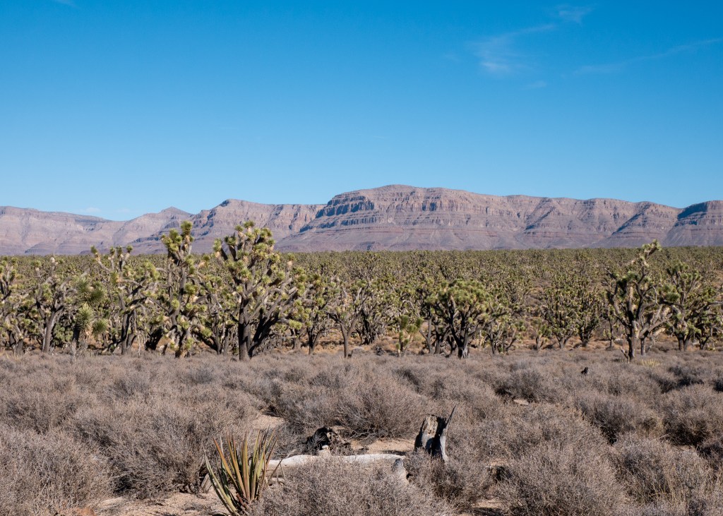
One of the things we noticed during our 2-hour drive from Las Vegas to Grand Canyon West was the volume of Joshua Trees that we passed. It turns out that we were actually driving through the Joshua Tree Forest, which has one of the highest concentrations of Joshua Trees in the world. We stopped here for a quick photo opportunity before continuing on to our next stop – the Hoover Dam.
The Hoover Dam is located on the border of Arizona and Nevada, and its purpose is to prevent flooding from the Colorado River. Visitors are required to pass through security before they can access the pedestrian walkway along the Mike O’Callaghan-Pat Tillman Memorial Bridge – from here, you can take photos and admire the Hoover Dam. While I always knew I had a small fear of heights (which might be hard to believe given how much I enjoy hiking), my fear of standing too close to railings on bridges became apparent during this visit – I was hardly able to approach the railing, and the idea of holding my phone near it to take a photo was unfathomable. I felt incredibly uneasy on the bridge and will admit that it became an emotional experience (yes, there were tears). With some help from Justin, I was finally able to bring out my camera (secured around my neck with straps) and take the photo below, before promptly making my way off the bridge!

Just a couple minutes away from the Hoover Dam is a great spot to take in views of Lake Mead. Not only is Lake Mead popular for water activities such as sailing, fishing and recreational boating, Lake Mead also “irrigates more than one million acres in the United States and Mexico. The lake’s water can reach kitchens in Tucson, lawns in Los Angeles, [and] farms of the Imperial and Mexicali valleys.” Clearly, Lake Mead is an important body of water for multiple reasons. As a side note, it is a good thing I have started taking pictures of information boards during my last few trips – there is no way I would be able to remember all these details ツ!

Our final stop before heading back to Las Vegas was to visit the ghost town of Nelson. Justin is fascinated by ghost towns, and we had originally hoped there would be time to visit Calico on our way to Las Vegas, but it was removed from our plans early on, as it was too far out of the way. However, Justin did not let this stop him – he just found a different ghost town to visit.
I have been to a couple other ghost towns previously – one was in Jerome in Arizona, which is actually an active ghost town with businesses in operation. The other is Bankhead near Banff, Alberta, which I would consider to be a true deserted ghost town – all that remains in Bankhead are partial building structures and foundations. Nelson did not appear to be deserted – when we arrived, there was a wedding taking place, another photographer taking pictures of what appeared to be someone’s graduation, a movie being filmed, and even a music video.
My first impression of Nelson was that there were several building structures still in-tact, amongst a sea of old, broken down vehicles – it was a lot of stuff. There is a list of rules that visitors will see upon entrance, with the first rule indicating that visitors must start by checking into the store, where you are required to pay an entrance fee of $1 USD. The other rules are hopefully intended to be tongue-in-check ツ.

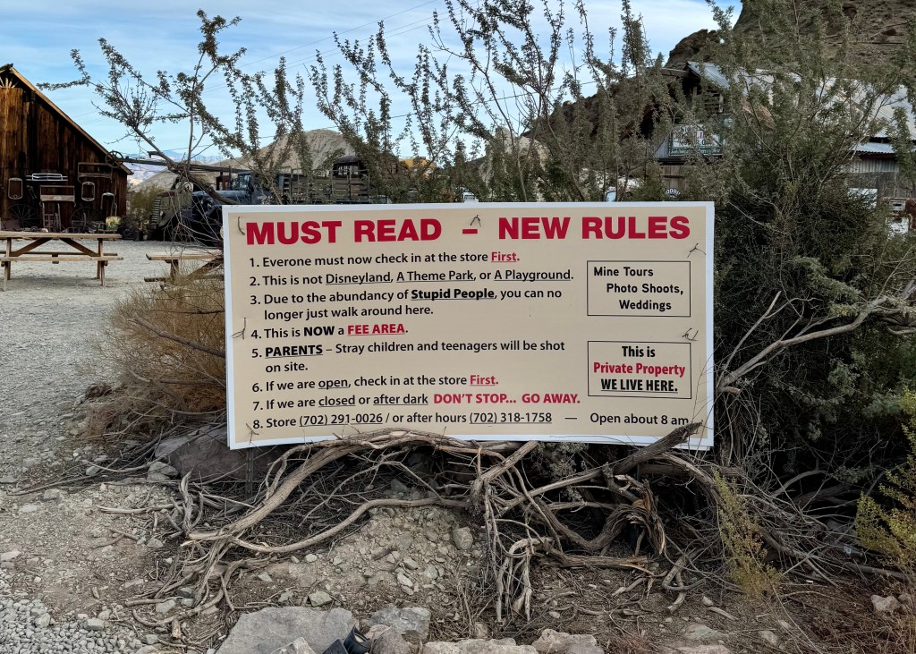
While Nelson does offer tours of the abandoned mining town, we arrived too late in the day and had to do our own exploring, instead. While not what I expected, it was still a worthwhile stop!

Our second day of exploring outside Las Vegas was a bit shorter than our previous day (when we were in Death Valley), leaving us a bit of time to explore the Las Vegas strip in the evening. We explored the extravagant hotels and casinos, watched a show at the Bellagio Fountain, and I even tried my luck at slots – somehow I managed not to lose any money, but I also did not win… I started and ended with $10 ツ. We also enjoyed a fun meal at Nacho Daddy – we ordered the Vegan Flaming Chick’n Fajitas, where the server literally lights your food on fire before serving it!
Well, I think that sums up our latest trip to the desert!
Always grateful,
Michelle