
It is hard to believe that 2025 is officially over, and it is once again time for me to round up all the local hikes we did throughout the year within two hours of home and tell you all about it! I will be honest that 2025 was “light” for local/day trip hikes – we did a lot of hiking in general, but most of it was during trips to places I have not yet documented. I guess that means I better get bloggin’!
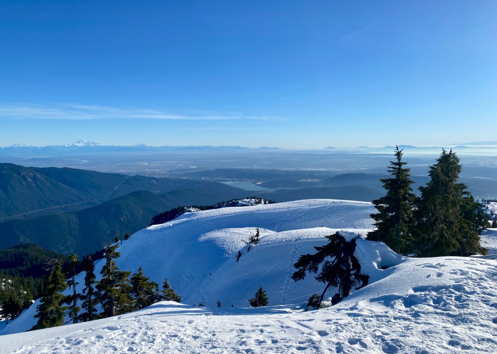
Pump Peak, North Vancouver (Mount Seymour) – January 2025:
My best friend, Iwona, and I wanted to go snow shoeing one day, and decided to make our way to Mt Seymour. We were initially going to snow shoe along one of the Mount Seymour Discovery Snow Shoe trails, but when we found out there was no fresh snow (and fresh snow is helpful for snow shoeing), we decided to pivot our plans and hike instead (with crampons, of course).
It was a beautiful, sunny day, and we initially decided to hike to Brockton Point. However, it only took us around 40-minutes to reach the end (before having to turn around), and since we were not ready to go back yet, we decided to continue onwards to Pump Peak. It was a challenging – but fun – hike, almost 7km in length, and we were rewarded with beautiful views of Vancouver at the top.
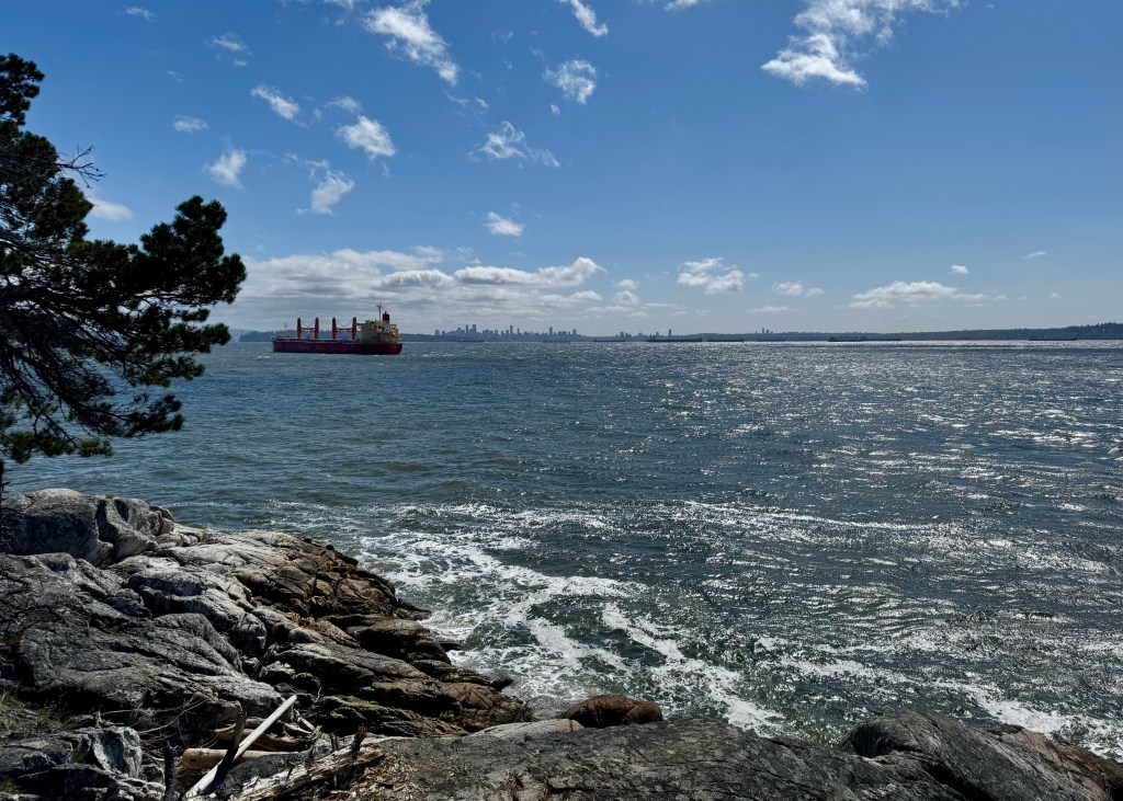
Lighthouse Park, West Vancouver – April 2025:
We had some unexpected sunny weather in April this year, and we were looking for a lower elevation trail to complete, as the higher elevation trails would still be covered in snow. We decided to go to Lighthouse Park, which has a network of trails you can explore in West Vancouver right by the Pacific Ocean – you can truly pick your own adventure!
For this visit, we opted to do the Arbutus Knoll and Eagle Point Loop, which was a great option for a short nature hike with beautiful views of the coast. This trail is almost 3.5km long, has an elevation gain of 180m and took us exactly 1 hour to complete – Lighthouse Park is truly a great spot if you are looking for a more “laid back” hike.
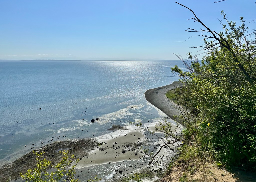
Lily Point Marine Park Loop, Point Roberts – April 2025:
Lily Point Marine Reserve is located in Point Roberts, a small part of Washington only accessible through Tsawwassen (South Delta). I would consider this trail to be more of a nature walk rather than a hike – the trail is is 3.1km long, has minimal elevation gain (83m) and is rated easy on AllTrails. While the trail is mostly amongst the tall forest trees, there is an opportunity to “detour” from the main path and walk along the beach. From here you will get beautiful views of the coast line and ocean, and we even saw several eagles flying above us high in the sky.
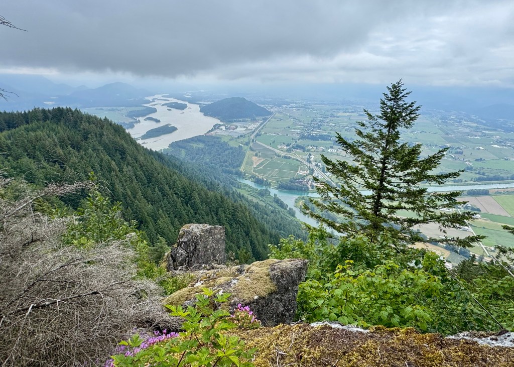
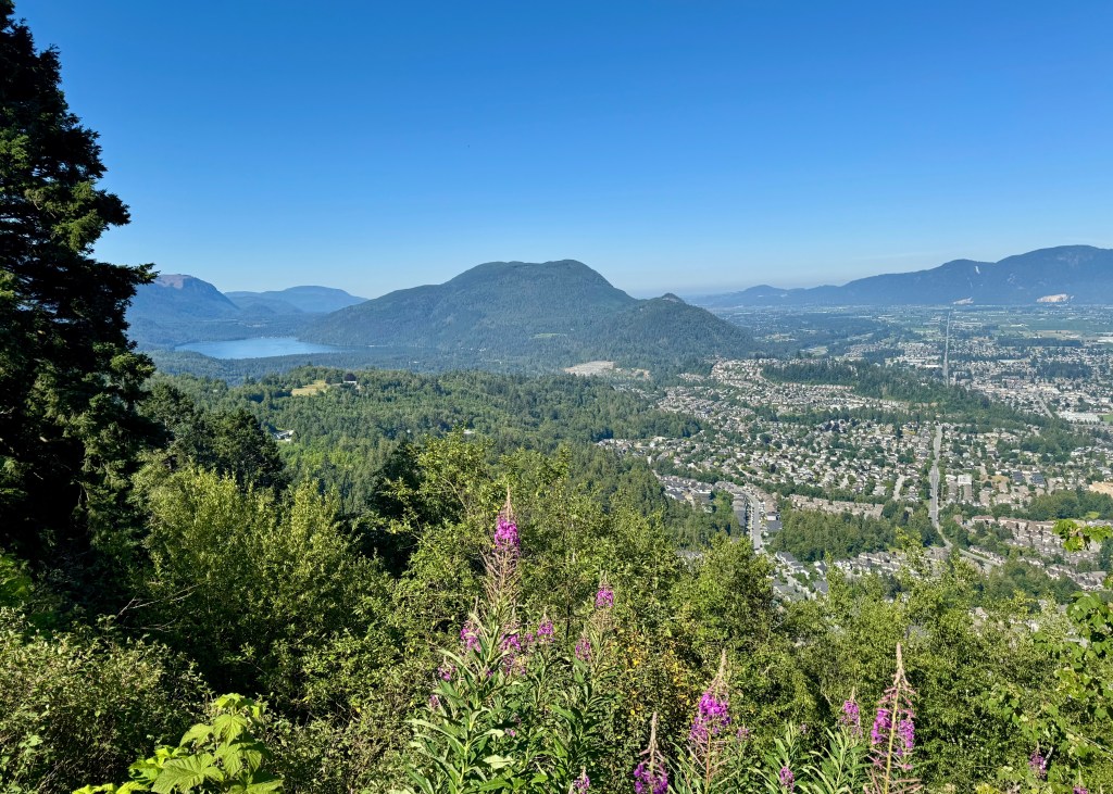
Baker Rock, Abbotsford – June 2025:
Baker Rock is a 6.3km trail located in Sumas Mountain Regional Park in Abbotsford. The trail is mostly a forest service road, except for approximately the final 1km before reaching the main view point, which provides beautiful views of the Fraser Valley. Similar to Lighthouse Park, Sumas Mountain Regional Park has several trails to choose from – we are hoping to go back this year (2026) and complete this trail again, but this time we want to stop and experience the beauty of Chadsey Lake.
Mount Thom via Thom Creek Trail, Chilliwack – July 2025:
This trail is located in Chilliwack, which as of November 2025, also happens to be home now for Justin, myself and our dogs! We spent some time exploring the Chilliwack area after completing this trail, realizing how beautiful it is in the valley, and how much the area has to offer in terms of amenities. Specifically, we went to Ambleside Coffee for a caffeine fix and baked goods, and then went to Sidekick Brewing for deep dish pizza and a cold beer after our hike. Around 5 months after this hike, we purchased our first detached home in Chilliwack – we are looking forward to exploring more of the Chilliwack trails once the weather improves!
But for now, back to telling you about Mount Thom via Thom Creek Trail. The trailhead is located in a residential area, and is almost 7km long with an elevation gain of 400m. The trail is a steady climb to the top, but fortunately is mostly tree covered, making it tolerable on a hot summer day (but you will still want to start early). At the top of the trail you will be rewarded with stunning views of the place we are now proud to call “home!”
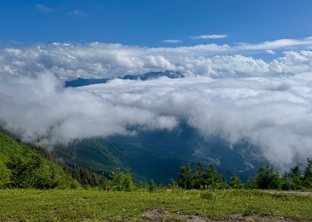
Elk Mountain, Chilliwack – July 2025:
The Elk Mountain trail is probably the hardest local hike we did in 2025. This nearly 9km out-and-back trail is also located in Chilliwack, and took us a little under 3-hours to complete.
What makes this hike challenging is the elevation gain of almost 800m. Fortunately, this hike is almost entirely in the forest, making it a good option on a warmer day or if you are starting the hiker later in the day. The trail opens up once you reach the alpine, but this is a very short portion of the trail.
Unfortunately for us, there was a lot of cloud coverage at the top of Elk Mountain, which impacted what we were able to see. Apparently, on a clear day, you are able to see other mountains along the Canadian and US border, including Mt Baker.
The most “exciting” part of this hike was that a couple hikers heading back down Elk Mountain had warned us that they saw a skunk in the alpine! While not a huge safety threat, the idea of Justin and I, or our dogs, getting sprayed by a skunk was definitely enough to keep me on high alert. Fortunately, we never saw this elusive creature, and I was able to relax during our descent ツ.
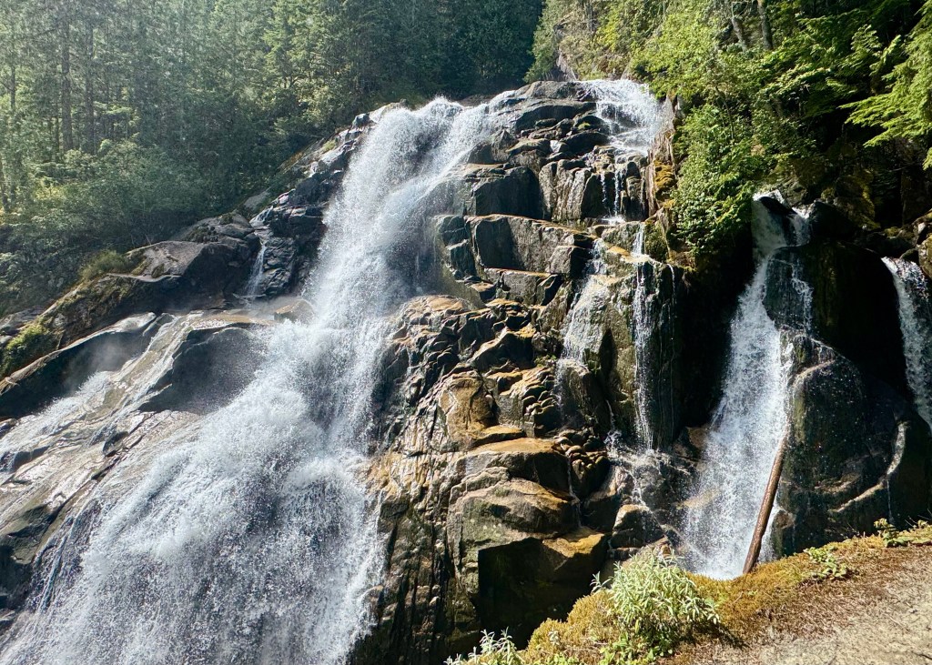
Crooked Falls, Squamish – August 2025:
The Crooked Falls trail is located in Squamish, and while not very long in length (a little over 5km), it is considered a hard hike, as it is a consistent uphill climb all the way to the Falls – you will gain over 500m in elevation over approximately 3km.
Note that the road to get to the Crooked Falls trailhead is not paved – make sure your vehicle choice is appropriate (ours definitely was not). Also, please be careful once you reach the Falls – we noticed after we completed the hike that there were flowers at the trailhead marker in honour of someone who had fallen into the Falls and passed away a couple weeks prior.
Well, on a more positive note, that is a wrap for 2025! Moving forward, 2-hours within home is going to look a bit different after relocating to Chilliwack – we are looking forward to exploring more of the Fraser Valley in 2026 ツ!
Wishing everyone a healthy, prosperous and adventure filled New Year!
Always grateful,
Michelle
