Justin, our dogs and my parents did a quick weekend trip to Galiano Island back in May 2025. However, after our visit, we felt we had “unfinished business,” and ended up booking a day trip back to Galiano Island in June – that is why this post is called One Island, Two Trips ツ. I will start by telling you all about the first trip!
Continue reading One Island, Two Trips – Galiano IslandTag: travel

Local Hikes of 2025
It is hard to believe that 2025 is officially over, and it is once again time for me to round up all the local hikes we did throughout the year within two hours of home and tell you all about it! I will be honest that 2025 was “light” for local/day trip hikes – we did a lot of hiking in general, but most of it was during trips to places I have not yet documented. I guess that means I better get bloggin’!
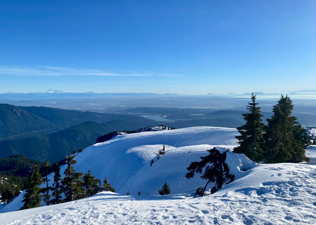
Pump Peak, North Vancouver (Mount Seymour) – January 2025:
My best friend, Iwona, and I wanted to go snow shoeing one day, and decided to make our way to Mt Seymour. We were initially going to snow shoe along one of the Mount Seymour Discovery Snow Shoe trails, but when we found out there was no fresh snow (and fresh snow is helpful for snow shoeing), we decided to pivot our plans and hike instead (with crampons, of course).
It was a beautiful, sunny day, and we initially decided to hike to Brockton Point. However, it only took us around 40-minutes to reach the end (before having to turn around), and since we were not ready to go back yet, we decided to continue onwards to Pump Peak. It was a challenging – but fun – hike, almost 7km in length, and we were rewarded with beautiful views of Vancouver at the top.
Lighthouse Park, West Vancouver – April 2025:
We had some unexpected sunny weather in April this year, and we were looking for a lower elevation trail to complete, as the higher elevation trails would still be covered in snow. We decided to go to Lighthouse Park, which has a network of trails you can explore in West Vancouver right by the Pacific Ocean – you can truly pick your own adventure!
For this visit, we opted to do the Arbutus Knoll and Eagle Point Loop, which was a great option for a short nature hike with beautiful views of the coast. This trail is almost 3.5km long, has an elevation gain of 180m and took us exactly 1 hour to complete – Lighthouse Park is truly a great spot if you are looking for a more “laid back” hike.
Lily Point Marine Park Loop, Point Roberts – April 2025:
Lily Point Marine Reserve is located in Point Roberts, a small part of Washington only accessible through Tsawwassen (South Delta). I would consider this trail to be more of a nature walk rather than a hike – the trail is is 3.1km long, has minimal elevation gain (83m) and is rated easy on AllTrails. While the trail is mostly amongst the tall forest trees, there is an opportunity to “detour” from the main path and walk along the beach. From here you will get beautiful views of the coast line and ocean, and we even saw several eagles flying above us high in the sky.
Baker Rock, Abbotsford – June 2025:
Baker Rock is a 6.3km trail located in Sumas Mountain Regional Park in Abbotsford. The trail is mostly a forest service road, except for approximately the final 1km before reaching the main view point, which provides beautiful views of the Fraser Valley. Similar to Lighthouse Park, Sumas Mountain Regional Park has several trails to choose from – we are hoping to go back this year (2026) and complete this trail again, but this time we want to stop and experience the beauty of Chadsey Lake.
Mount Thom via Thom Creek Trail, Chilliwack – July 2025:
This trail is located in Chilliwack, which as of November 2025, also happens to be home now for Justin, myself and our dogs! We spent some time exploring the Chilliwack area after completing this trail, realizing how beautiful it is in the valley, and how much the area has to offer in terms of amenities. Specifically, we went to Ambleside Coffee for a caffeine fix and baked goods, and then went to Sidekick Brewing for deep dish pizza and a cold beer after our hike. Around 5 months after this hike, we purchased our first detached home in Chilliwack – we are looking forward to exploring more of the Chilliwack trails once the weather improves!
But for now, back to telling you about Mount Thom via Thom Creek Trail. The trailhead is located in a residential area, and is almost 7km long with an elevation gain of 400m. The trail is a steady climb to the top, but fortunately is mostly tree covered, making it tolerable on a hot summer day (but you will still want to start early). At the top of the trail you will be rewarded with stunning views of the place we are now proud to call “home!”
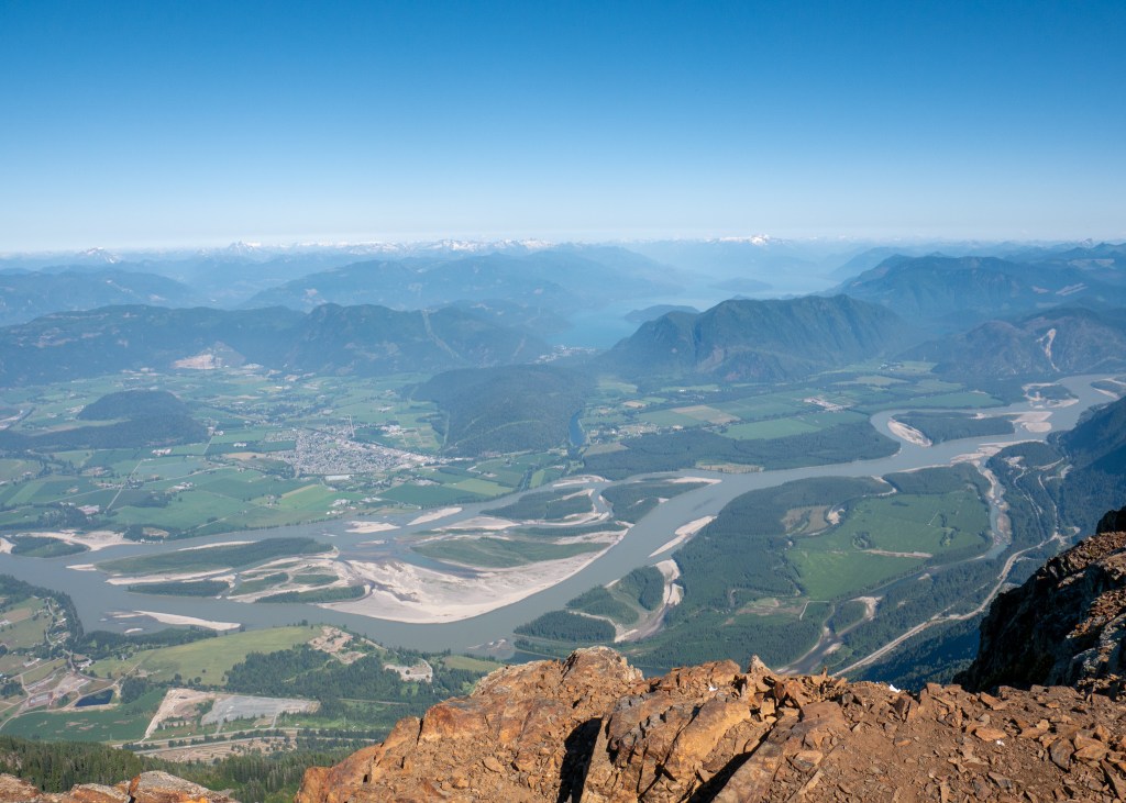
Elk Mountain, Chilliwack – July 2025:
The Elk Mountain trail is probably the hardest local hike we did in 2025. This nearly 9km out-and-back trail is also located in Chilliwack, and took us a little under 3-hours to complete.
What makes this hike challenging is the elevation gain of almost 800m. Fortunately, this hike is almost entirely in the forest, making it a good option on a warmer day or if you are starting the hiker later in the day. The trail opens up once you reach the alpine, but this is a very short portion of the trail.
Unfortunately for us, there was a lot of cloud coverage at the top of Elk Mountain, which impacted what we were able to see. Apparently, on a clear day, you are able to see other mountains along the Canadian and US border, including Mt Baker.
The most “exciting” part of this hike was that a couple hikers heading back down Elk Mountain had warned us that they saw a skunk in the alpine! While not a huge safety threat, the idea of Justin and I, or our dogs, getting sprayed by a skunk was definitely enough to keep me on high alert. Fortunately, we never saw this elusive creature, and I was able to relax during our descent ツ.
Crooked Falls, Squamish – August 2025:
The Crooked Falls trail is located in Squamish, and while not very long in length (a little over 5km), it is considered a hard hike, as it is a consistent uphill climb all the way to the Falls – you will gain over 500m in elevation over approximately 3km.
Note that the road to get to the Crooked Falls trailhead is not paved – make sure your vehicle choice is appropriate (ours definitely was not). Also, please be careful once you reach the Falls – we noticed after we completed the hike that there were flowers at the trailhead marker in honour of someone who had fallen into the Falls and passed away a couple weeks prior.
Well, on a more positive note, that is a wrap for 2025! Moving forward, 2-hours within home is going to look a bit different after relocating to Chilliwack – we are looking forward to exploring more of the Fraser Valley in 2026 ツ!
Wishing everyone a healthy, prosperous and adventure filled New Year!
Always grateful,
Michelle

Honeymooning in Kaua’i – Part 2 of 2
Well, I think it is safe to say that this has not been my most active year for writing blog posts. Even my goal of writing shorter, more focused posts, did not help – it has been 3 months since I published my last post. For those who do not know, I work a full-time job and also do photography professionally on the side, and I had an incredibly busy year between weddings, family sessions and other events.
Now that I am done with my excuses, it is time to write the sequel to my last post. In Honeymooning in Kaua’i – Part 1 of 2, I discussed the hikes we completed on Kaua’i, while in this blog post, I will talk about other activities we did on the Island, where we ate, and where we stayed!
Accommodation
Let’s start with accommodation. While researching different places to stay, we quickly learned that Kaua’i is expensive – if you want to come here for a visit, the faster you realize this and accept it, the easier it will be to choose your accommodation. After hours of searching, we decided to stay at the Lawai Beach Resort.
The Lawai Beach Resort is a beautiful property located on the southern part of Kaua’i. While it is a timeshare property, owners have the option of putting their unused weeks into a rental pool via Hawaii Time Share Exchange, which is how we completed our booking.
We ultimately decided on a 1-bedroom ocean-view suite in the Banyan Building at the Lawai Beach Resort – it was very clean, well-equipped and spacious with a full kitchen, living room, dining area, bedroom, bathroom and in-suite laundry. While we did not spend a lot of time in the suite, we liked having a comfortable space to return to after a long day of exploring. The property also has great amenities such as multiple swimming pools, roof top decks, as well as a gym. The only amenity missing is a restaurant; however, there is one right across the street, Beach House Restaurant – Kaua’i (although, we did not eat here as it is considered fine dining aka $$$ and had limited vegan options), and many others within a five-minute drive.
While we were very happy with our accommodation overall, the only downside was that we did not spend a lot of time on the southern part of the Island. While this area is stunning, we just happened to spend most of our time on the east (near Kapa’a). It also takes almost one-and-a-half hours to drive to the northern part of the Island, a drive we ended up doing twice. A couple of our friends who are seasoned Kaua’i visitors will spend two weeks on the Island and split their accommodation time equally between the north and the south – something for us to consider for our next visit ツ.
Food
Now that you know where we stayed, it is time to talk about where we ate!
Remember how I said Kaua’i is expensive? Well, the high prices do not end with accommodation – the restaurants are expensive, too, which should not be a surprise – I can only imagine that it is very costly to bring supplies to Hawai’i from other areas of the world, and then add in the exchange rate…
This is why it was important to us to have a kitchen at our accommodation, as we opted to make most of our meals here. We stopped at Costco and Walmart to pick up oatmeal for breakfast, snacks (apples, protein bars, etc.), and items for making sandwiches for lunch and basic dinner meals such as pasta with veggies and vegetarian meatballs. While I know this does not sound exciting or glamorous, this was the only way we could keep the trip affordable. We also picked up a “paper” cooler from Walmart to keep our food cold while we were on the road during the day!
But, do not worry – we did treat try some of the local restaurants during our visit:
- RUSSELL’S by Eat Healthy Kaua’i: One of two fully vegan restaurants on the entire Island, and as it turns out, they are now permanently closed. I am really glad we had a chance to try and support this restaurant while it was open – I enjoyed the Jalapeño Cheddar Bites and Tempeh “Bacon” B.L.T. Sandwich. I also had a lovely chat with the owner, and learned that the restaurant was named after his beloved late Golden Retriever, Russell.
- Kaua’i Island Brewing Company: Our friends know that Justin and I are always on the lookout for a brewery, especially after a hike. We went to Kaua’i Island Brewing Company during happy hour (another great way to save a bit of money while traveling) and ordered the edamame, onion rings and a cold beer – would highly recommend!
- The Greenery Cafe: This was our first stop after getting off the plane and getting our rental car – we were looking for something quick but healthy, and stumbled upon The Greenery Cafe as it was close to the airport. I enjoyed my Kale Salad from here – everything tasted very fresh and made for a nice first impression of the Island.
- Paco‘s Tacos Cantina: This was my first time having Paco’s Tacos Cantina, even though it appears to be a chain restaurant throughout the United States. We ordered the veggie vegan burritos from the Kilauea location on our way back to the Lawai Beach Resort after completing the Hanakapi’ai Falls trail earlier in the day. At this point, it was past 4pm, I had just completed over 12kms of hiking, and I had not eaten anything except a few snacks since breakfast that day – I was definitely “hangry” (and I was also soaking wet – to add to my mood), and while it was not the best burrito I have ever had, it hit the spot (you can ask Justin, but hangry is a real emotion for me).
- We had shave ice from three different locations: Waikomo Shave Ice, Wailua Shave Ice and The Fresh Shave. Shave ice is very popular in Kaua’i and we loved all the flavours we tried from all three places.

- Dark Horse Coffee Roasters: Justin always like to have a coffee for the road (and we did a LOT of driving in Kaua’i), and he really enjoyed the oat milk latte from Dark Horse Coffee Roasters – we stopped here multiple times before leaving the southern part of the Island!
- Holy Grail Donuts & Bakery: These donuts are made fresh to order! You get to choose your toppings, and then a few minutes later, you have hot, fresh donuts – delicious!
Activities
Believe it or not, but we did participate in activities other than hiking – hard to believe, right ツ? Here is what we did:
- Kaua’i Coffee Company: We did a self-guided walking tour of the Kauai Coffee plantation, which takes you through a series of information boards that talk about the history of the estate, types of coffee grown on the farm, the growing process, and more. Note that the self-guided tour is free and can be completed any time during operating hours, but you will need to reserve your spot for one of the paid guided tours in advance – here is your warning to plan ahead! While on the property, you can also try different coffee samples, get a coffee to-go, or buy your own coffee beans to take home (Justin bought the biggest bag available, and I am surprised he found somewhere to put it in his luggage).
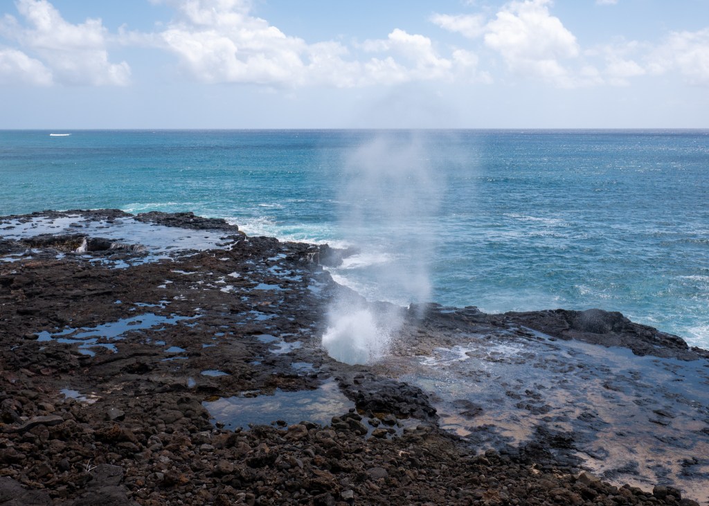
- Spouting Horn Blowhole: Not far from the Lawai Beach Resort, and on the way to to the Kaua’i Coffee Company, we stopped to see the Spouting Horn Blowhole – this is a natural phenomenon where the ocean water shoots through a lava tube along the coast. The Spouting Horn Blowhole is fenced off, as people have died by getting too close to blowholes in the past.
- Warehouse3540: This is a small series of shops located right by Waikomo Shave Ice. I love browsing through small shops while traveling, and this was probably my favourite find on Kaua’i – I ended up purchasing a fresh water pearl necklace from one of the vendors here (Lily Koi jewelry). Other shopping areas I enjoyed were Old Koloa Town and The Shops at Kukui’ula.
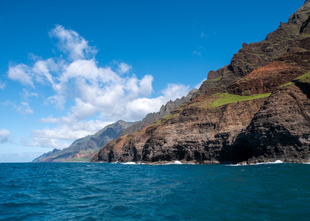
- Makena Charters – Nā Pali Coast Boat Tour: One of the activities we “splurged” on during our trip was a boat tour of the Nā Pali Coast. The tour was around 5-hours long, and there are two time options – 8:30am and 2pm. We opted for the afternoon boat as the reviews we read indicated better lighting for photos, although I will say it was still very bright! The tour takes you from the south-west of the Island, all the way to the north, allowing visitors to see the entire “rugged” Nā Pali Coast. All throughout, the tour guides talked about the history of the Coast, discussed film productions, and pointed out different points of interest such as waterfalls and small goats walking along the ridges. Once we turned around to start heading back, we stopped for a short snorkel where Justin swam next to a sea turtle (at a respectable distance), and we even saw dolphins and a humpback whale! The dolphins truly put on a show, as they were playing and riding the waves from the boat. Overall, we really enjoyed the tour – the only downside was that the water was very rough. However, our boat driver was very skilled and experienced – Justin was incredibly impressed with his ability to approach the coastline; he even managed to drive under some waterfalls, where several people voluntarily got wet!
- Lydgate Farms Chocolate Tour: The other activity we splurged on was a tour of Lydgate Farms. We really enjoyed the chocolate tour we did in Costa Rica in 2024, and wanted to have another opportunity to learn more about the chocolate making process. Lydgate Farms is situated on 46 acres of land in Kapa’a and was rated in the top 50 best chocolates in the world. Hawai’i is the only US state that can grow chocolate, since it is situated 22° north of the equator (within the tropical zone for growing chocolate). During the tour, we learned about the chocolate making process, toured the property, and tried multiple chocolate and fruit samples. I really appreciated how one of the tour guides would give me extra dark chocolate samples when I told her I was vegan – I ended up with so much chocolate that I had to put all my samples in a bag, and ate them over the next few days! Overall, we really enjoyed the tour and would recommend it to others!
- We also checked out several beaches during our trip. My top two favourites were Poipu Beach and Hanalei Bay. Poipu Beach is located on the southern part of the Island, and was very close to our accommodation. It was a great spot for relaxing and swimming, and likely snorkelling, although we did not attempt to snorkel here. We also saw many sea turtles and sea lions resting here on the beach! Hanalei Bay and Pier, located on the north side of the Island, was the nicest beach on the Island, in my opinion. It is a great spot for a beach walk (especially since you can also walk out onto the pier), for swimming, lounging and surfing. I wish we could have spent more time here.

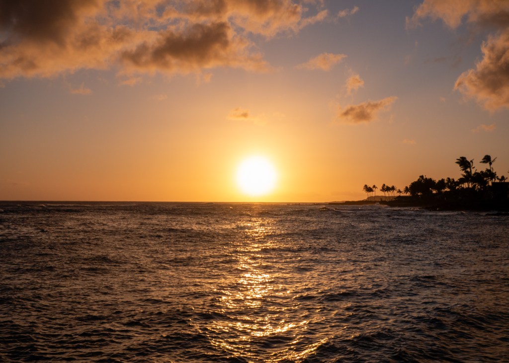
- Sunsets: There is nothing quite like a Hawaiian sunset! We watched the sunset almost every evening right across the street from our accommodation – it was beautiful.
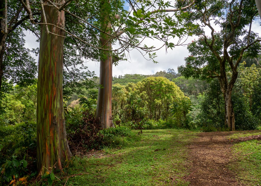
- Rainbow Eucalyptus Trees: We made a quick stop at the Keahua Arboretum after we finished the Moalepe Trail (discussed in Part 1) to see the beautiful red and green colours of the Rainbow Eucalyptus Trees!
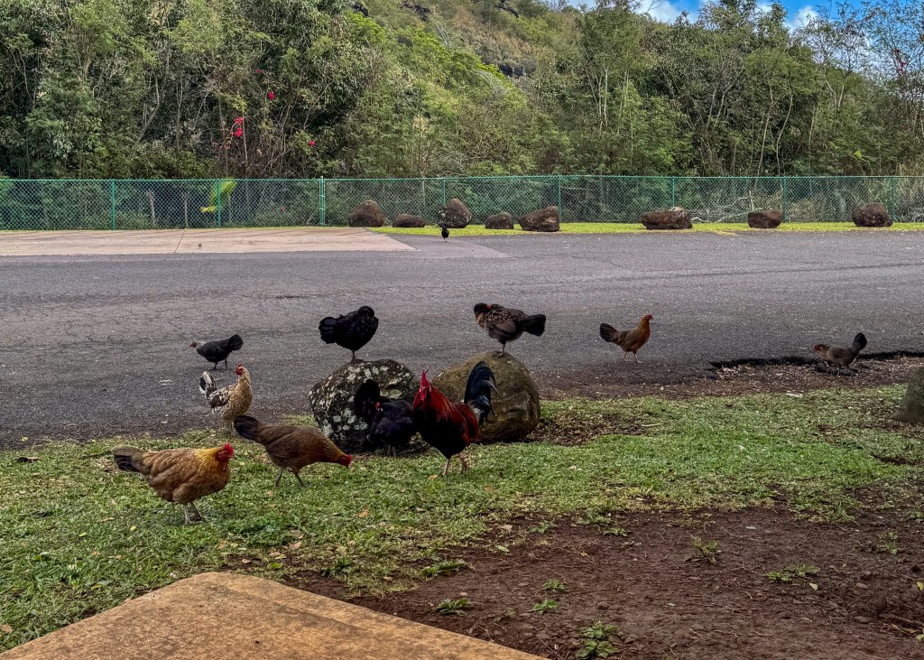
The last thing that I will share about Kaua’i that has nothing to do with accommodation, food or activities is that there are so many wild chickens roaming the Island! Legend has it that “domestic” chickens (belonging to the Polynesians) escaped their coops during the hurricanes in 1982 and 1992, which is why there are now chickens literally everywhere on Kaua’i. The best part is that the roosters will let you know when it is time to rise and shine in the morning – around 4:30am – meaning you do not need to worry about setting your alarm clock when visiting Kaua’i ツ.
Always grateful,
Michelle

Honeymooning in Kaua’i – Part 1 of 2
When I have to start a blog with “Back in [insert month],” that is when I know I have fallen behind on my posts. You might recall that the reason I started this blog was to better remember and reflect on my trips, but if I am writing posts several months later, I have probably already forgotten some details! Here is my commitment to being more timely with my posts.
Back in March, Justin and I travelled to the island of Kaua’i, Hawaii for our honeymoon. While I love to travel and explore, by the end of a trip, I usually feel like my cup is full and I am ready to go home. But at the end of this trip, I was not ready to leave and I felt we had “unfinished business” in Kaua’i. Nevertheless, we maximized the time we had, and are looking forward to a trip back in the future ツ.
Our primary reason for choosing Kaua’i for our honeymoon was because of all the amazing hiking opportunities available on the Island. In this post, I will discuss all the trails we completed in detail, and I will publish a “Part 2” that will cover our other activities, food and accommodation. I am hoping that writing shorter, more focused blogs, will also help me to publish posts more frequently ツ.
Anyway – while our trip to Kaua’i was only a week long, we managed to complete six hikes, and they are discussed below in order of completion!
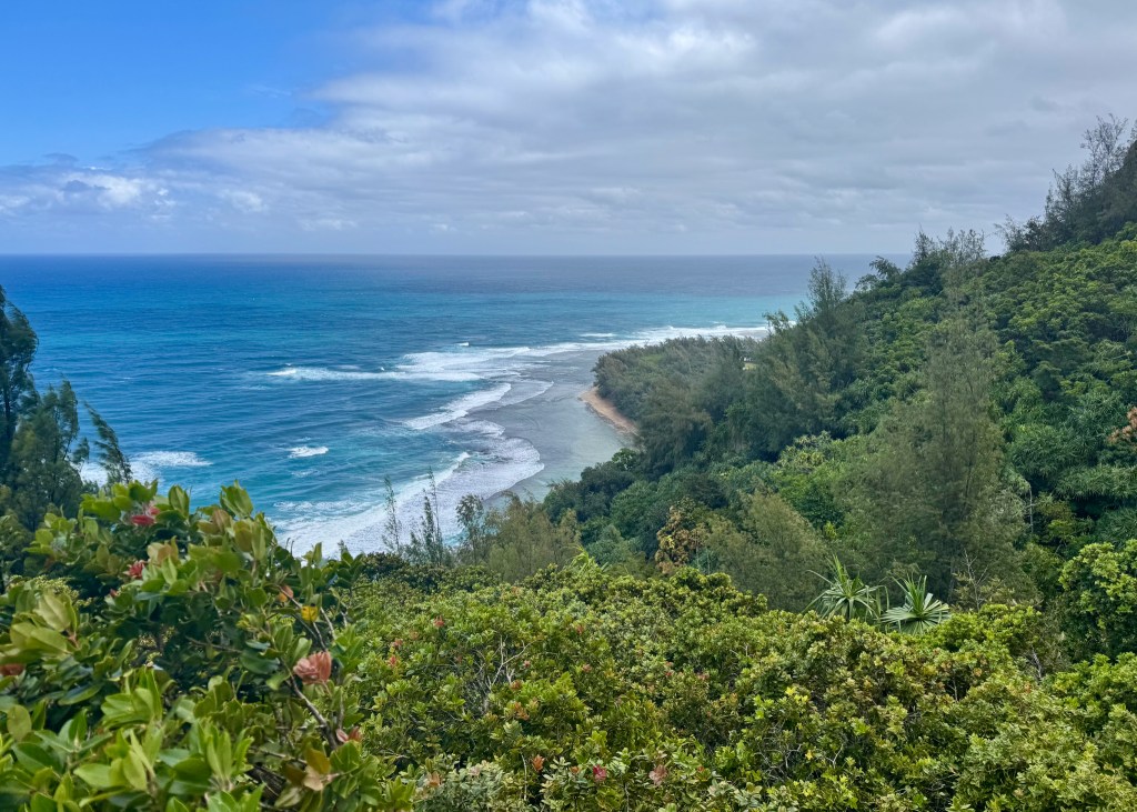
Maha’ulepu Heritage Trail:
The Maha’ulepu Heritage Trail was the first hike we did in Kaua’i. This hike is classified as moderate on AllTrails – it is 6km long, and has an elevation gain of 122m. The trail is located along the southern coastline of the Island, providing beautiful views of the ocean and coastal cliffs all throughout. The trail ends at Gillin’s Beach, but you will pass several other sights along the way including Poi’pu Bay Golf Course, as well as the biggest limestone cave and fossil site in Hawai’i – Makauwahi Cave (although, we only encountered the Cave because we took a “scenic detour”). If you are looking for a fairly easy and peaceful walk near the ocean, I would definitely recommend the Maha’ulepu Heritage Trail.

Sleeping Giant (Noun Mountain) East Trail:
The Sleeping Giant East Trail was my second favourite hike that we did in Kaua’i. This hike is approximately 5km long, and it gets its name from a local legend, which tells of a “giant who feasted so much at a party in his honour that he laid down for a nap and never awoke” (as per AllTrails) – and I can verify that from a distance, the Sleeping Giant actually looks like a face! What made this hike a bit challenging was the fact that we did it right after it rained, making the trail slippery, and there is also a rock scramble near the end. However, the panoramic views from the top were worth it – we could see the nearby towns of Kapa’a and Waliua, as well as the Pacific Ocean. We found out after-the-fact that there are apparently caves you can explore right under the main viewpoint – if you end up at this trail, make sure you do not miss them like we did. But in the end, I am happy to report that we successfully completed the hike without waking the Sleeping Giant ツ.
It is also noteworthy that there are two Sleeping Giant trails – the one we completed was on the east, but there is also a west trail that is shorter – it is only 2.7km long. We did not try this option, but basic math tells me that you should be able to get to the views faster, although it will be a steeper climb over a shorter distance.
Ho’opi’i Falls Trail:
The Ho’opi’i Falls Trail is an easy walk we completed after conquering the Sleeping Giant. We felt we had some energy to keep going, but we were not looking for anything too strenuous as it was starting to get warm, and we were starting to get hungry (or “hangry” in my case ツ). This is an out-and-back trail that is mostly flat (64m elevation gain), ending at a beautiful little waterfall with a swimming hole. The hardest part of the trail was getting down to the waterfall, but there are lots of trees you can use to support your descent. This was the perfect way to end our hiking/walking activities for the day before heading back to our hotel to relax by the pool.

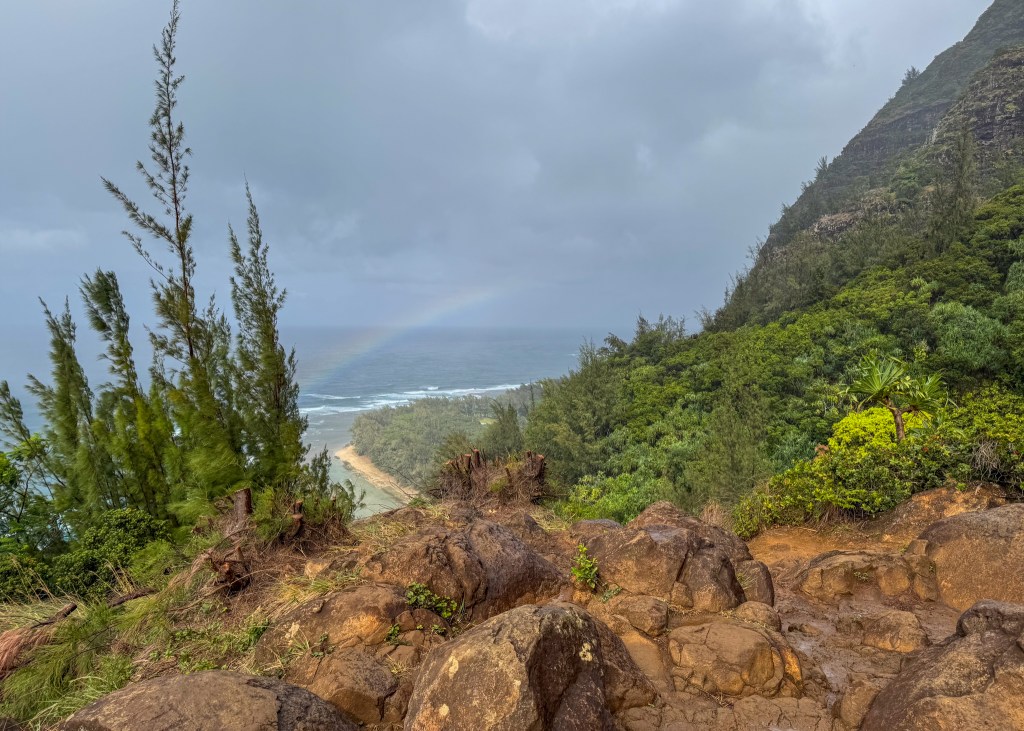
Hanakapi’ai Falls:
Hanakapi’ai Falls was my favourite hike of the trip, but was also the hardest and scariest, as well. This hike is located along the Nā Pali Coast in Haena State Park, and visitors are required to make reservations in advance. We tried making vehicle reservations on multiple occasions – staying up late as reservations are released 30-days in advance in HST – but we were not successful and had to opt for the shuttle option, instead. When we arrived at the park and saw that the parking lot had room for less than 10 vehicles, we were not surprised that we were unable to get a vehicle reservation!
Anyway, the Hanakapi’ai Falls trail is rated as hard on AllTrails, as it is 12.2km in length and has an elevation gain of 726m. Most of the elevation gain is at the start, before crossing the first stream crossing, and then a gradual incline for the remainder of the trail. When we first arrived at the trail head (via shuttle), there was a Haena State Park employee who greeted us, advising about the Hanakapi’ai Falls trail and conditions. When she told us that we would have to cross the “stream” five times before getting to the falls, I imagined a little bit of water, where the bottom of my hiking boots might get wet… but I was very wrong. In this case, the stream went part way up my thighs, and I am nearly 5’8” tall! Because it was raining, and had heavily rained during previous days, the stream was rising and moving very quickly, making it hard to get across. Luckily, we had hiking poles to help with stability and water resistance, but it was still difficult to walk through the stream, nonetheless. It was a bit funny how concerned I was about getting wet during the first crossing, but forgot all about it by the third time ツ.
The trail itself is absolutely stunning – the surrounding forest is lush with greenery, and from certain points on the trail, you can see the Nā Pali Coast. The Hanakapi’ai Waterfall, itself, is one of the most impressive waterfalls I have ever seen – the lower falls (where the trail ends) are around 300-400 ft tall, but it is estimated that the entire waterfall is over 1,600 ft! We were able to stand right at the bottom, providing for an amazing perspective of the waterfall – we could feel the mist, and some people were even swimming at the base.
While we did not go swimming at the waterfall, it was raining so hard that it looked like we had gone swimming… I was absolutely soaked, head-to-toe (and to think I bothered doing my hair that morning). It was actually very difficult to get a photo without water on the phone or camera lens. To make matters worse, I had my passport in my Lululemon belt bag which also got wet. When I got home, I had to replace my passport well before the expiry date, and I had to complete a special form which explained how my passport was damaged – lesson learned to leave my passport at my accommodation the next time I decide to hike in a rain storm!
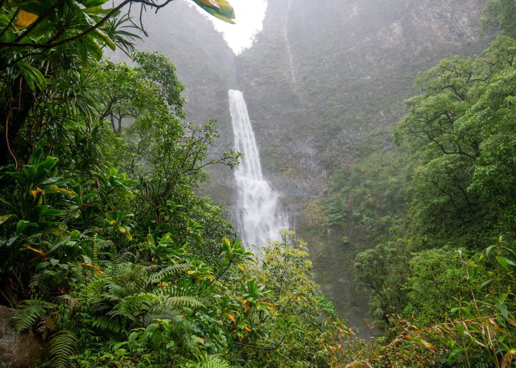
In the end, this trail was quite the adventure – it was slippery and muddy from all the rain, and the stream was more difficult to cross than usual due to the weather conditions – but it was all worth it!
Waimea Canyon Trail to Waipo’o Falls:
This trail is located in Waimea Canyon, which is often referred to as the Grand Canyon of the Pacific. Waimea Canyon was created by a volcanic eruption over 5 million years ago, and is 13 miles long, 1.5 miles wide and 2,500 feet deep. While there are many trails to explore at Waimea Canyon, we did not have a lot of time here, as we were heading on a Nā Pali Coast Boat Tour in the early afternoon (which I will tell you about in Part 2 of this post). For this reason, we chose to do the Waipo’o Falls via Pu’u Hinahina and Canyon Trail, as it is a shorter hike – it is 4.2km long and took around 2-hours to complete.
The first part of the trail consists of walking through the forest as you descend into the canyon. I will note that there is a considerable decline on this trail, as it has an elevation gain of 342m (over 2.1km). I was happy to have a hiking pole with me, as there were also a lot of rocks and tree roots to navigate. However, once you emerge from the trees, you will not be surprised as to why Waimea Canyon is referred to as the Grand Canyon of the Pacific – it is truly an impressive sight of red and orange rock, mixed with greenery (much more colourful than the actual Grand Canyon).
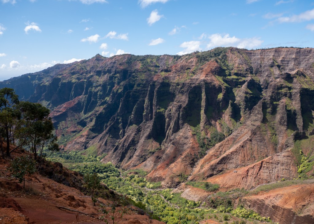
I am embarrassed to say that as I am writing this blog post, I am realizing that we did not see (or look for) Waipo’o Falls during the hike. There is a small waterfall at the end of this trail, which I had mistaken for Waipo’o Falls, but it is not the 800 foot waterfall we should have seen. Consider this your warning and reminder to make sure you look for this impressive waterfall (which fortunately, we did see from a different viewpoint in the park).
Make sure to also stop by the swing on the trail (which is located before the small waterfall) for a great photo opportunity!
Moalepe Trail:
The final hike we did in Kaua’i was the Moalepe Trail. Similar to Ho’opi’i Falls, this hike made for a leisurely afternoon walk. The trail is 8km long, and took us around 2-hours to complete.
I will be honest, the first part of the trail is not very exciting – you will walk along a dirt path for approximately 45-minutes without a single view in sight. However, stick to it because around the half way mark (2.5km into the trail), you will encounter a swing (yes, another one) with incredible valley views – a luscious, green canopy of trees. The swing is actually difficult to get onto, as it is quite high – Justin had to hold the swing in place for me, while I climbed onto a nearby stump to pull myself up! But, the struggle to get on was worth it – it was a great photo opportunity, especially with the scenery behind me.
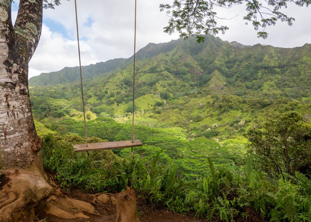
The views at the swing were definitely the highlight of the trail. If you are short on time, you could easily turn around and head back from here. The remainder of the trail is not well maintained – we would recommend wearing long pants as there is a section of “bush whacking” on the trail. Also, the end of the Moalepe Trail connects to another popular trail in the area called Kuilau Ridge Trail. We decided to briefly venture down the Kuilau Ridge Trail (which transition at the bridge), and came across another nice valley view, but it was not as nice as the view from the swing. The more I think about it, the more I would recommend to turn around after you reach the swing to make the most of your time ツ.
Well, I think that covers all the hikes we did in Kaua’i. Which one(s) would you try if you decide to visit this beautiful island? Make sure to keep an eye out for Part 2 of this blog post, which I hope to publish very soon!
Always grateful,
Michelle

A Quick Visit to Mount Rainier
It has been a busy few months – it is hard to believe that 2025 is now half over! Does anyone else feel like this year is flying by, or is it just me?
But in all seriousness, between local hikes and adventures, as well as trips to the United Stated, Europe and Galiano Island, I have a lot to write about. But, I am going to start with our most recent trip to Mount Rainier National Park as it is currently fresh in my head!
Our trip to Mount Rainier National Park was booked pretty last minute – we had some extra time off from work, and found accommodation available near the park entrance… so we went for it!
The drive from our home to Ashford, Washington was about five hours long. This included our wait time at the border, and we also made a couple of stops along the way, one of them being our mandatory stop at Trader Joes (in Bellevue). If you have read my other blog posts, you will know that all of our trips to the United States involve a visit (or multiple visits) to Trader Joes. Here, we picked up a couple of premade meals, along with snacks and all the fixings for making sandwiches.
Our accommodation in Ashford was a cute, small cabin located just 9-minutes from Mount Rainier’s Nisqually Entrance. We arrived here on Saturday afternoon around 2:30pm, quickly dropped-off all our stuff and changed before heading off to the park.
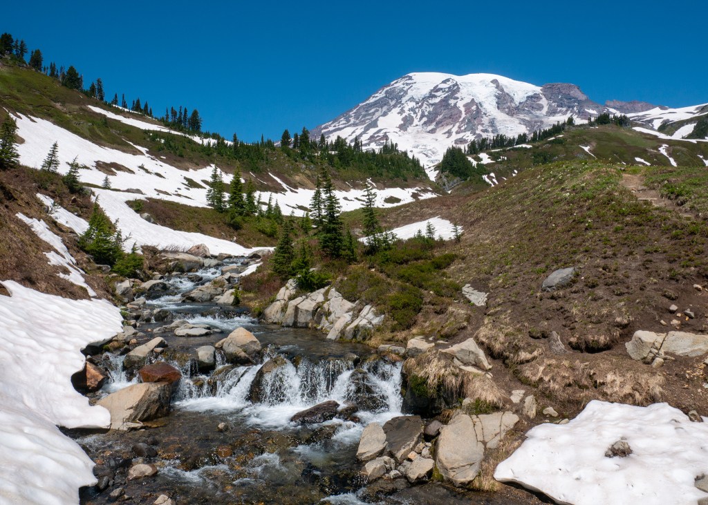
For our first partial day in the park, we decided to do the Comet Falls via Van Trump Trail. This trail is located about 30-minutes past the park entrance. I will note that because we were entering the park quite late in the day (3:00pm), there was only a small line-up of cars in front of us.
The drive towards the trail was down a windy road, mostly in a forested area, and there are no views of Mount Rainier, itself, from this part of the park. Speaking of Mount Rainier, it was not until after we arrived at the park that I learned Mount Rainier is an active volcano – it is a bit scary to think about! But, I digress…
While our research warned us that the parking lot for Comet Falls was small, we did not realize just how few spots would be available! The pull-out on the side of the road has room for around 15 vehicles, which were all taken when we arrived, forcing us to park on the side of the road. Pro tip: If you find yourself in a situation where you need to park on the road, make sure your tires are behind the white line, otherwise you will receive a violation notice. We saw many vehicles with orange tickets stuck to their window!
Anyway, after parking, changing into our hiking shoes, and grabbing our backpacks and hiking poles, it was time to start the trail. The Comet Falls via Van Trump Trail is rated hard on AllTrails – it is about 5.6km in length, and apparently has an elevation gain of 392m. However, my activity for this trail in the AllTrails application indicated that I completed 549m in elevation gain – I do not know which one is correct… let’s split the difference! Either way though, I agree with this rating – the trail is difficult as it has a steady incline all the way to the main falls. There are very few flat areas on the trail, and there are also a lot of rocks and tree roots to navigate.
However, do not let this rating deter you – the views are all worth it!
Soon after starting the trail (while you are still near the main road), you will be rewarded with views of Christine Falls, which is a much smaller waterfall compared to Comet Falls. After this, you will enjoy a peaceful walk through the forest before reaching a rocky opening on the trail. I found this to be the most difficult part of the trail, mostly due to the uneven ground, the heat (since there is no shade), and there was also a tree that had fallen onto the trail that you have to climb over or under. But, we persevered!
After the rocky opening, you will once again enter the forest, and after a series of small switchbacks, you will turn the corner and be greeted by Comet Falls.
One word: Wow. This was probably my favourite view of the Falls – nestled amongst the mountains and trees, with the water flowing through the valley.
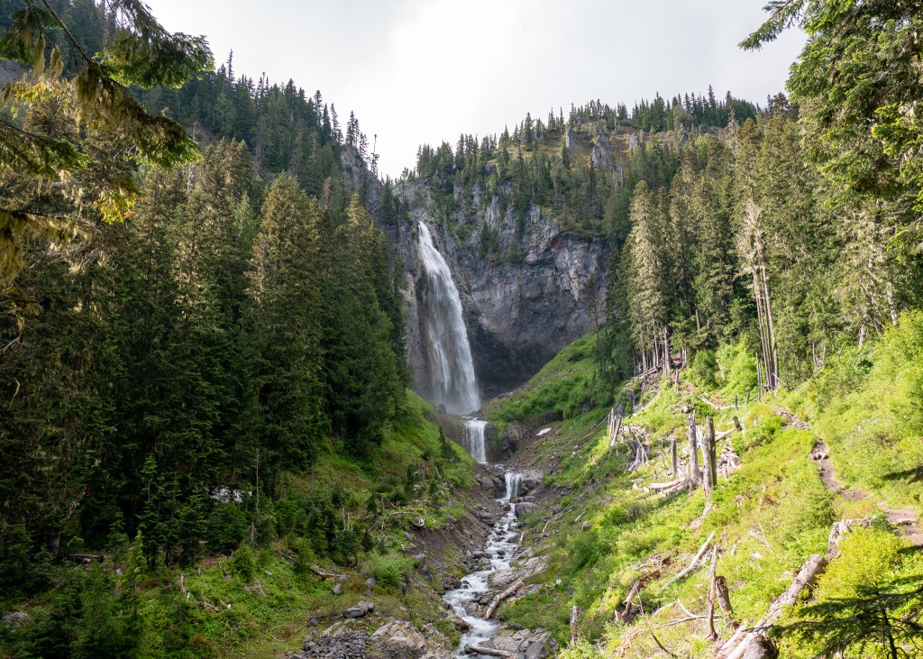
After taking in the Falls from this view point, we continued along the trail to the very end, where we got close and personal with it – I could feel the water spraying me, which was actually very refreshing!
Given that it was quite late in the day by the time we finished the Comet Falls trail, we decided to head back to our accommodation and eat, before heading to bed – we were getting up early the next day to do the Skyline Loop.
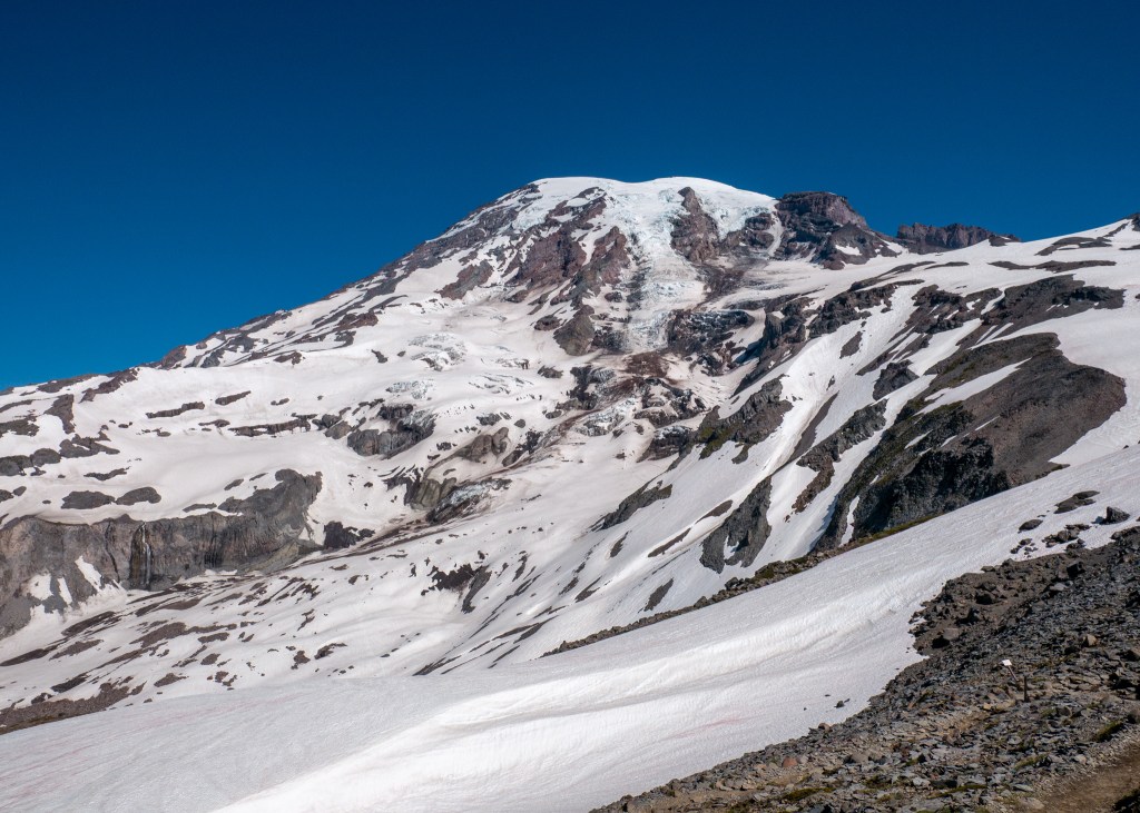
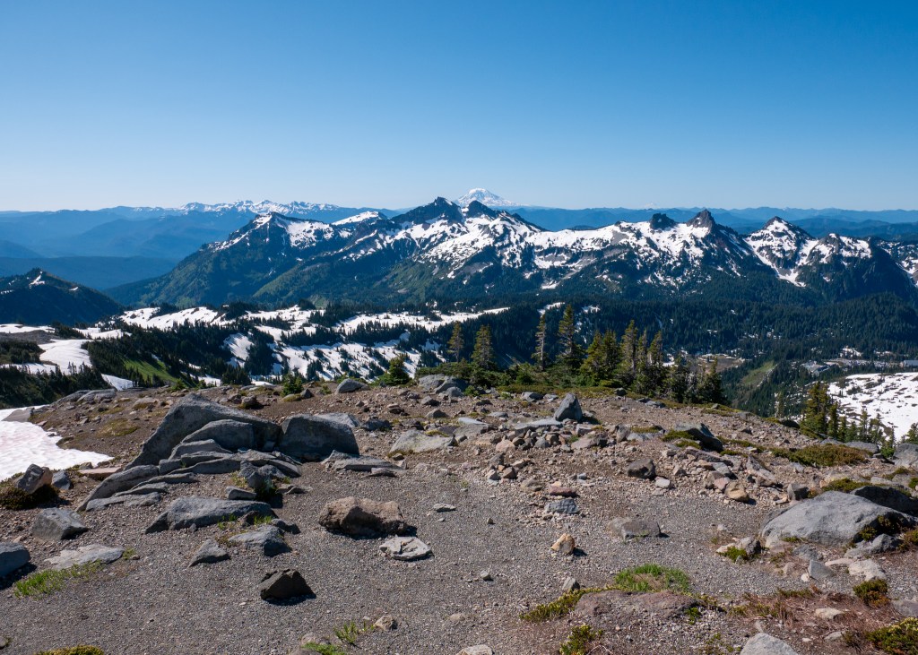
According to AllTrails, the Skyline Loop is the number one trail in the park. This hike is 9km long, and has an elevation gain of 542m. The trail took us a total of 4-hours and 20-minutes to complete, including the many stops we took to eat and take photos, but our actual walking time was 3-hours and 15-minutes, which is very comparable to the AllTrails estimate.
Our research indicated that the parking lot near the Skyline Loop trailhead fills-up quickly. For this reason, we left our Airbnb at 6:45am, and arrived at the parking lot around 7:30am, and by this time, the lot was nearly half full! The Jackson Visitor Centre is also located near the trailhead, but take note that there is a separate parking lot for hikers – the Visitor Centre parking has a limit of 2-hours.
The Skyline Loop starts off on paved concrete, which made me think we were getting off to an easy start. But do not be fooled – while the path might be paved, there is an immediate incline. This, combined with the fact that the trailhead starts at 5400ft above sea level, made for a difficult start to this hike. I have noticed a couple of times now from our trips to other National Parks that I have difficulty breathing (while hiking) at higher elevations. Is it just me?
Anyway, it was not long before we were unable to see the concrete beneath us – we encountered snow, and lots of it! Even though it was late June, our visit to Mount Rainier was still considered to be the shoulder season. And, given the high elevation, it was no surprise that the trail was still predominantly covered in snow. Fortunately, we came prepared with crampons and hiking poles. I would not have been successful on this trail without these items – we saw many people slipping and sliding in the snow.
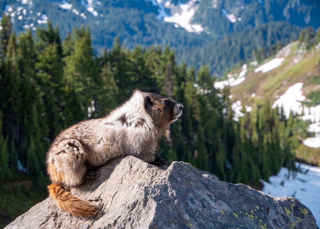
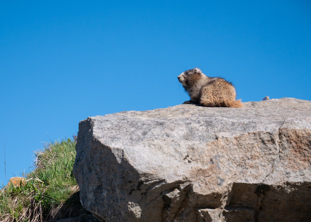
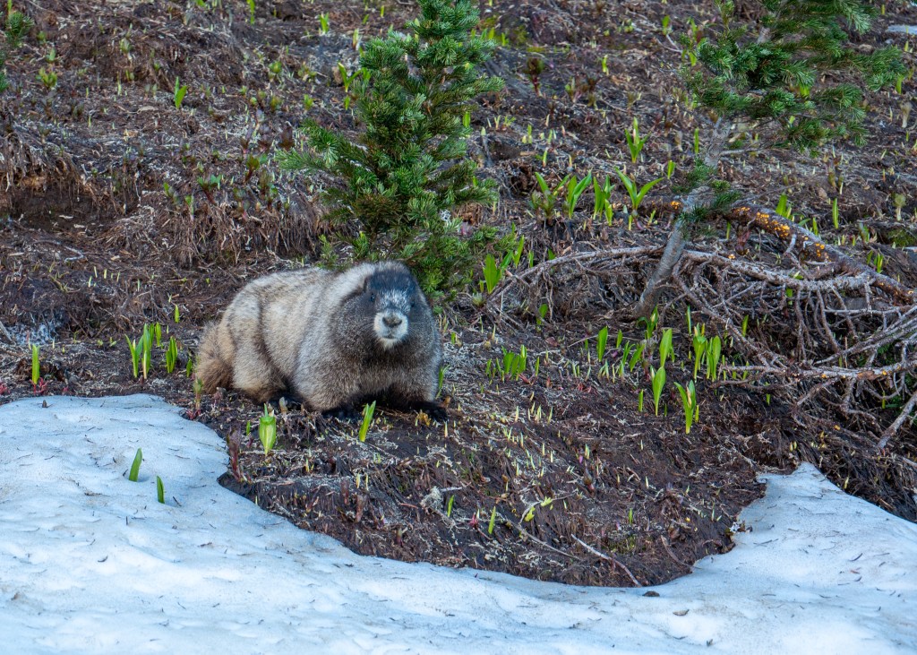
Shortly after we started the trail, we came across marmots! A couple of them were sunbathing on the rocks, while others were looking for food. We actually saw marmots multiple times throughout the hike. Our favourite encounter was when we saw them “in action.” I say it like this because it was not clear to us if they were playing, or fighting – but either way, it was very entertaining to watch. At one point, one of the marmots stopped playing/fighting, laid down and did not move for several minutes – we got a bit concerned. But not long after, we noticed the marmot had moved, and was making a mad dash across the snow-covered hills!
Some hikers we talked to on the trail apparently also saw a bear, but we did not see any other wildlife aside from marmots and a couple of deer at the other end of the trail.
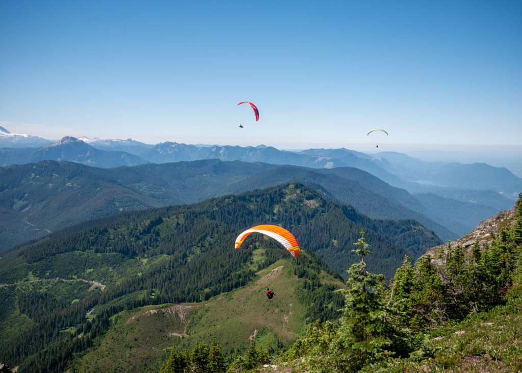
The views along the trail, especially of Mount Rainier, were absolutely stunning. I found myself stopping to take photos every few minutes – which definitely contributed to the extra hour of our non-hiking walking time. There were also amazing views of other nearby mountains along the trail – Mount St. Helens, Mount Adams and even Mount Hood which is located in Oregon. The best views of these three neighbouring mountains was from Panorama Point, which is located around 3km from the start of the trailhead.
By far, the trickiest part of the trail was going downhill. Downhill is difficult enough on its own, but the soft, partially melted snow added another element of challenge. While crampons and hiking poles were helpful in this situation, I still went down once, and also had many other close calls. Some hikers resorted to sliding down the bigger hills – while it looked like fun, it is not something I was willing to try!
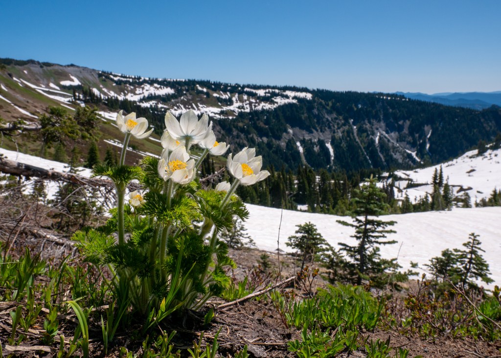
While navigating the snow provided for extra challenges, we encountered a couple Mount Rainier volunteers on the trail who educated us on the importance of hiking in the snow, and not being tempted to step into the meadows where the snow had already melted, as this is damaging to the plants trying to recover after a long, cold winter. We were even lucky enough to see some wildflowers starting to bloom!
Mountain views, marmots and wildflowers were not the only sights that the Skyline Loop offered – we also passed several water streams during the hike and saw another waterfall – Myrtle Falls – near the end of the trail. The waterfall area is very busy, as many visitors will start the Skyline Loop trail in the opposite direction, and some will even turn around after Myrtle Falls, as it is located only a short walk from the Visitor Centre.
Overall, we very much enjoyed this hike – it is not surprising that the Skyline Loop Trail is considered the top hike in Mount Rainier National Park – we were surrounded by beautiful sights of nature and 360 degree mountain views for a little over 4-hours – what else can you ask for?
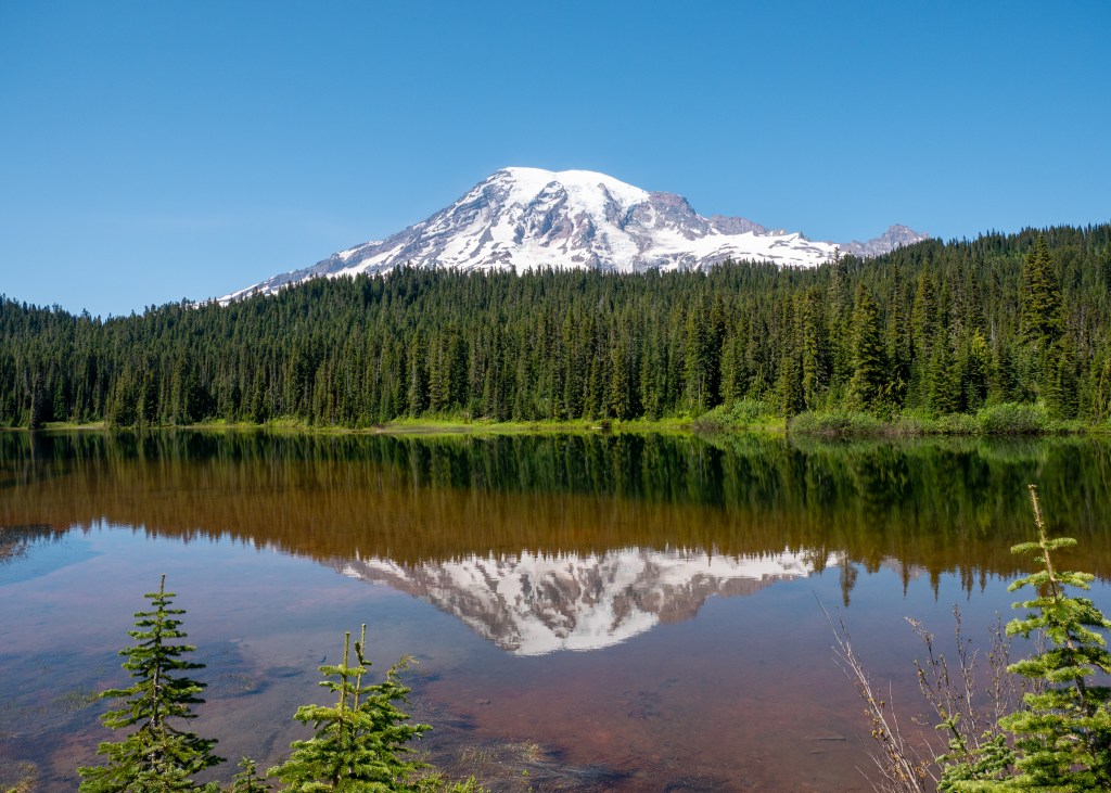
After completing the Skyline Loop Trail, we had lunch and grabbed a couple of souvenirs from the Visitor Centre (a colour poster with marmots, obviously ツ, and a magnet) before making our way to Reflection Lake. The Lake is appropriately named, as you are able to see a reflection of Mount Rainier in the water. It was stunning!
From here, we somehow found the energy to take on one more short, easy hike called the Bench and Snow Lakes Trail. This trail is 3.5km in length, has an elevation gain of 139m, and AllTrails suggests that it takes around an hour to complete.
As the name suggests, you will encounter two lakes along this trail, starting with Bench Lake. This was a beautiful lake, providing more views of Mount Rainier, because let’s face it, you cannot get tired of this sight. However, we preferred the views at Snow Lake, but only because it provided us with something new to see.

While walking towards Snow Lake, you will encounter a fork on the trail, and there will be a sign that indicates the direction for the camp sites – go left at the fork towards the campsites, as this area provides better views (in my opinion) of Snow Lake. My favourite vantage point was actually along the log that you need to cross to get to the camping area – the logs in the lake provided some beautiful foreground for photos, as we took in the sights of Snow Lake.
While the lakes were beautiful, the biggest downside to this trail was the bugs. While I did not think that the bugs were landing on me, they were just flying near me, I was wrong – I ended up with 7 new bites from this hike! I think they were mosquito bites, but I cannot be certain. Make sure to put on bug spray or wear loose clothing if you attempt this hike.
After completing the Bench and Snow Lakes Trail, we decided we were done with hiking for the day and started to make our way back to Ashford. Before going back to our Airbnb, we stopped at Rainier Basecamp Bar & Grill for a refreshing beverage – this was a cool spot to enjoy a drink after a long day of exploring, as it had great vibes and a massive patio, but they clearly had a busy day as they ran out of certain items on the menu!
Overall, we really enjoyed our short visit to Mount Rainier National Park, and look forward to returning one day to explore more areas of this beautiful landscape.
Always grateful,
Michelle

The Desert Called, and I Answered… Again (California & Nevada – Part 2 of 2)
After an eventful journey from Indio to Las Vegas, we ended the evening by watching the Vegas Golden Knights lose 6-0 to The Utah Hockey Club – not exactly the outcome we were hoping for! It was then time for bed, as we were up early the next day to head to the hottest place on Earth: Death Valley National Park.
As you may recall in Part 1 of this blog series, I explained that our primary reason for staying in Las Vegas was because both Death Valley National Park, as well as Grand Canyon West, are within a two-hour drive from Las Vegas. Since we had two full days before heading back home, we dedicated one day to the Park, and the other to Grand Canyon West, including some additional quick stops in Arizona and Nevada.
Day 1: Death Valley National Park:
As noted above, Death Valley National Park is approximately two hours west of Las Vegas. While most of your drive will be through the desert landscape, you will encounter one main city about halfway called Pahrump. We did not spend much time here, with the exception of a quick, impromptu stop when we saw the Pinkbox Doughnuts sign ツ. But in all seriousness, if you need coffee, snacks or gas, you can find all of this in Pahrump.
We made it to Death Valley National Park around 9:30am, making our first stop at the Furnace Creek Visitor Centre to check out the gift shop and pick-up a map of the Park. Note that the Park Ranger will request to see your Park Pass before they provide you with a map!
Death Valley National Park is huge – almost 3.5 million acres – and with only 6 hours of daylight available to us, we had to very selective about the stops we wanted to make. After talking to the Park Ranger and reviewing the map (which does an excellent job of highlighting the most popular stops, especially if you are under a time constraint), we decided to start with a hike through Mosaic Canyon. Described as an “out and back hike within polished marble narrows with unique colour patterns,” Mosaic Canyon did not disappoint! The hike is almost 6.5km long, and took us around 1.5-hours to complete. While I do not recall too much incline during the hike, there are some rock scrambles and narrow passages along the trail to justify the moderate rating on AllTrails.


Following our hike at Mosaic Canyon, we made a quick stop at the Stovepipe Wells General Store before continuing to the Harmony Borax Works site. It is worth noting that the Mesquite Flat Sand Dunes are right near the General Store; however, given that we were pressed for time, and we already saw the Kelso Sand Dunes in the Mojave Dessert, we opted to skip this stop and admire the Mesquite Flat Sand Dunes from a distance.
Our next stop was at the Harmony Borax Works, which is a short walking tour amongst the remains of a borax processing plant. Borax was Death Valley’s most profitable mineral, otherwise referred to as the “White Gold of the Desert.” As per one of the information signs:
“Borates – salt minerals – were deposited in ancient lake beds that uplifted and eroded into the yellow Furnace Creek badlands. Water dissolved the borates and carried them to the Death Valley floor, where they recrystallized as borax.”
Borax was then refined right here in Death Valley – a process that involved separating the crystal from mud and other salts. Unfortunately, Harmony Borax Works was forced to close in 1888 due to economic hardship, as borax was uncovered in other areas of California.

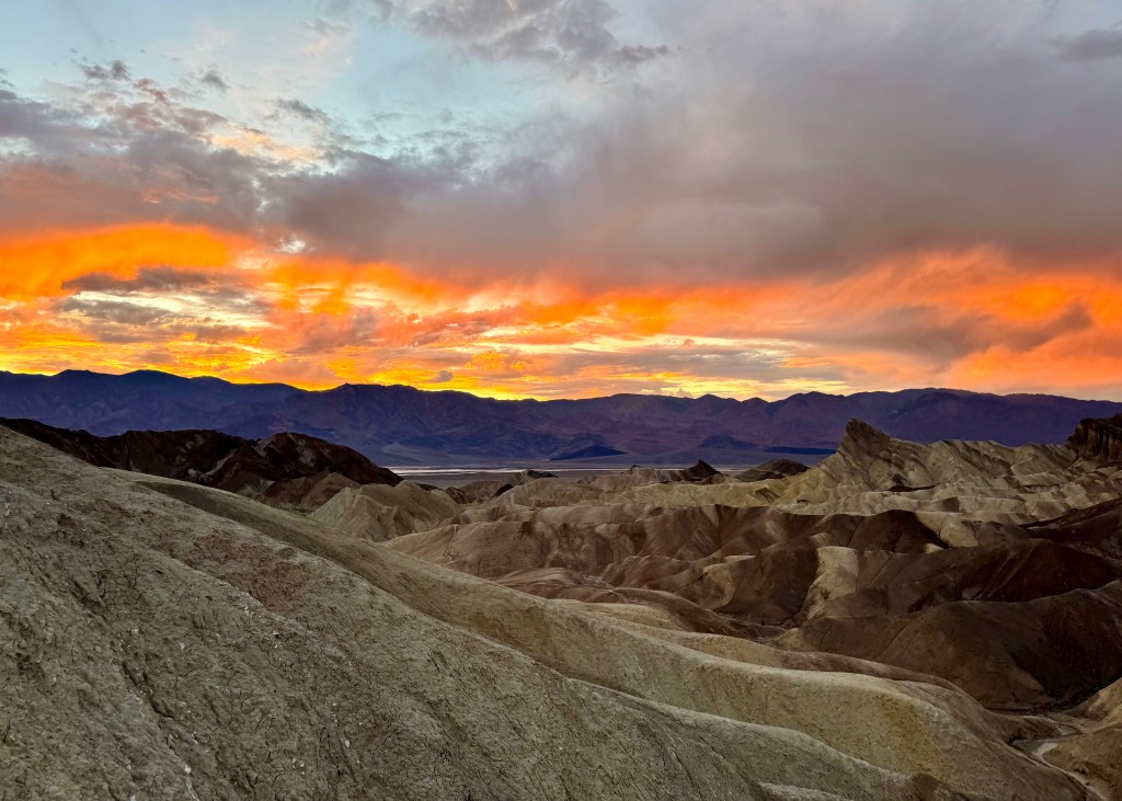
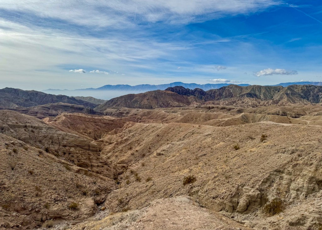
Our next stop was at Zabriskie Point, which provides beautiful landscape views of the Death Valley badlands. Unfortunately for us, a dark raincloud rolled into the area at the same time that we did, which was incredibly distracting (as you can see in the photo below). For this reason, we kept our time at Zabriskie Point brief, and decided we would return here later in the evening to watch the sunset – we were also hoping the rainclouds would disappear by then!

We continued our adventure through Death Valley by stopping at Badwater Basin, which is the stop I was most excited about. Badwater Basin is considered the lowest point in North America – it is 282 ft below sea level. There is actually a sign on one of the surrounding mountains that indicates where sea level begins – it is very surreal. What is even more interesting is that the Badwater Basin trail is actually a 3.1km walk along the salt flats! It was also during this moment that the sun came back out, making for a very special experience ツ.

After leaving Badwater Basin, we took the scenic way back to Zabriskie Point by driving down Artist’s Drive, a winding, one way road that takes you through the colourful rock formations of the badlands. While I do not know the name of the first stop we made along this drive, you cannot miss it – there is a clear pull out, and beautiful views for taking photos. There were also a couple of hills at this stop and if you are able, definitely climb to the top of one of them, as it provides another perspective of the salt flats.

The second stop we made was at Artist’s Palette. As the name suggests, the rock formation contains several different colours – white, teal and pink!

After leaving Artist’s Drive, we had exactly enough time to catch a magical sunset back at Zabriskie Point. While the rainclouds had not completely left the area, they did not affect the beautiful golden yellow and orange tones in the sky. It was the perfect way to end our time at Death Valley National Park. However, I feel as though we barely scratched the surface of what this Park has to offer, and we hope to be back in the future.
While it was not what we intended, we ended up driving back to Las Vegas mostly in the dark – personally, I do not like driving in the dark in places with which I am not familiar. However, we made it back safe and sound (credit to Justin), and we were even able to sneak in a delicious, quick meal at The Modern Vegan before they closed.
Day 2: Grand Canyon West and Other Sights of Arizona and Nevada
For our second full day in Nevada, we were up early and heading in the opposite direction. While Death Valley National Park was two hours west of Las Vegas, this time, we drove two hours east of Las Vegas to visit Grand Canyon West. The entrance to Grand Canyon West is actually in Arizona – make sure to take this into consideration while planning your visit, as you will change time zones!
One thing we did not realize prior to our trip is that Grand Canyon West is not considered to be part of the official Grand Canyon National Park. Grand Canyon West is owned by the Hualapai Tribe, and there is a separate entrance fee that visitors must pay – you cannot use your National Park Pass to gain entrance into Grand Canyon West.
Due to the time change, we arrived in Grand Canyon West around 10am, which appeared to be perfect timing – it was not yet very busy, and there was a lot of parking. From the parking lot, you are required to take a shuttle to the two main visitor spots: Eagle Point and Guano Point. Our bus driver told us that Eagle Point is the “warm up” for taking pictures at Guano Point, even though he also said it is not possible to take a bad picture at Guano Point.
Eagle Point gets its name from a rock formation amongst the canyon walls that quite literally looks like an eagle. There is also a Sky Walk you can pay for at Eagle Point, where you walk along a glass floor that provides you with a bird’s-eye view looking down into the canyon (I imagine it must be intentional to provide a bird’s-eye view at Eagle Point – get it?). We did not do the Sky Walk as this was an extra fee, and you are not allowed to take your phone or a camera onto the Sky Walk. Instead, Grand Canyon West provides photographers to take your picture on the Sky Walk, which you can purchase after taking in the views. There is also a short walking tour at Eagle Point that takes your through various structures of buildings used by the Hualapai Tribe, such as a Wikiup (a home made of Juniper and other brush) and a Navajo Sweat Lodge, which is used (as explained by one of the information signs) to “cleanse the mind, body and spirit.”

From Eagle Point, we got back on the shuttle to head to Guano Point. The bus driver was correct when he said Eagle Point was a warm up – the views of the Grand Canyon at Guano Point were truly incredible. We spent a lot of time walking around Guano Point taking videos and pictures, and also observing the number of helicopters flying through the Grand Canyon.


We were at Guano Point for around an hour before getting back on the bus and returning to the entrance. Overall, I would suggest scheduling around 2 to 3 hours at Grand Canyon West to fully take in the views, and possibly even enjoy lunch at Guano Point. We could have spent more time at Grand Canyon West, as there is one additional stop you can make at Hualapai Ranch; however, we had several stops we wanted to make on our way back to Las Vegas.
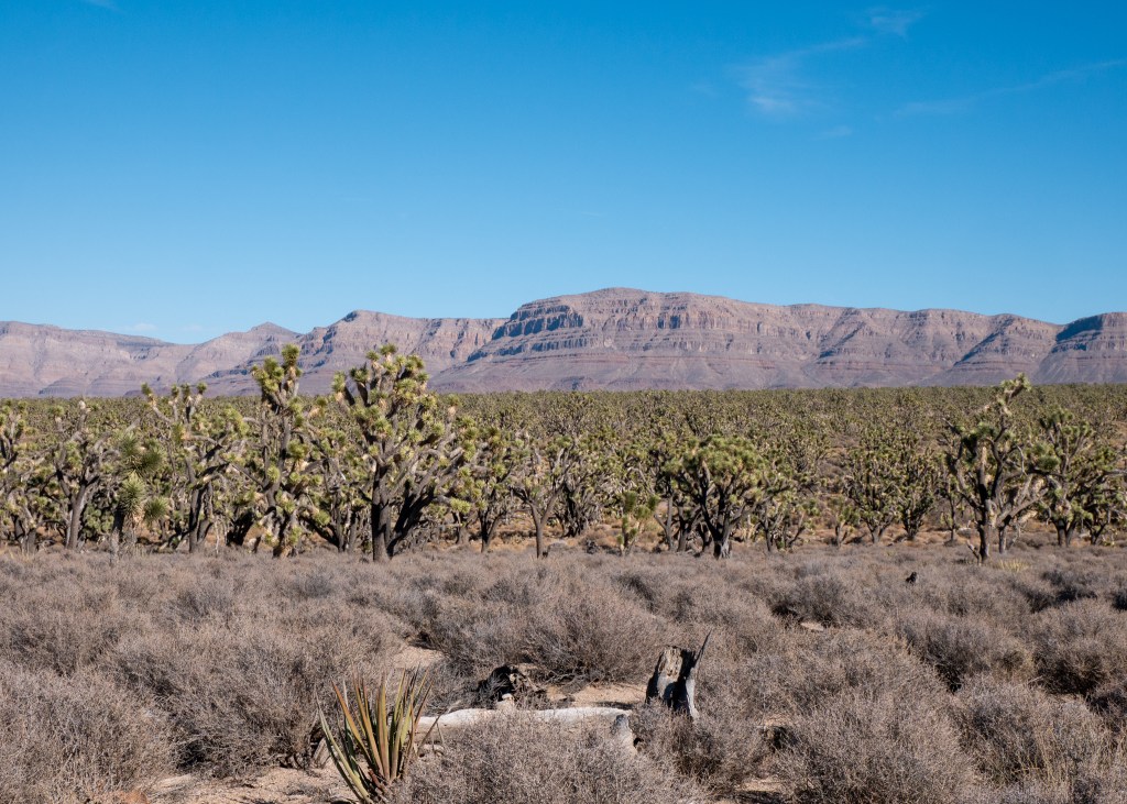
One of the things we noticed during our 2-hour drive from Las Vegas to Grand Canyon West was the volume of Joshua Trees that we passed. It turns out that we were actually driving through the Joshua Tree Forest, which has one of the highest concentrations of Joshua Trees in the world. We stopped here for a quick photo opportunity before continuing on to our next stop – the Hoover Dam.
The Hoover Dam is located on the border of Arizona and Nevada, and its purpose is to prevent flooding from the Colorado River. Visitors are required to pass through security before they can access the pedestrian walkway along the Mike O’Callaghan-Pat Tillman Memorial Bridge – from here, you can take photos and admire the Hoover Dam. While I always knew I had a small fear of heights (which might be hard to believe given how much I enjoy hiking), my fear of standing too close to railings on bridges became apparent during this visit – I was hardly able to approach the railing, and the idea of holding my phone near it to take a photo was unfathomable. I felt incredibly uneasy on the bridge and will admit that it became an emotional experience (yes, there were tears). With some help from Justin, I was finally able to bring out my camera (secured around my neck with straps) and take the photo below, before promptly making my way off the bridge!

Just a couple minutes away from the Hoover Dam is a great spot to take in views of Lake Mead. Not only is Lake Mead popular for water activities such as sailing, fishing and recreational boating, Lake Mead also “irrigates more than one million acres in the United States and Mexico. The lake’s water can reach kitchens in Tucson, lawns in Los Angeles, [and] farms of the Imperial and Mexicali valleys.” Clearly, Lake Mead is an important body of water for multiple reasons. As a side note, it is a good thing I have started taking pictures of information boards during my last few trips – there is no way I would be able to remember all these details ツ!

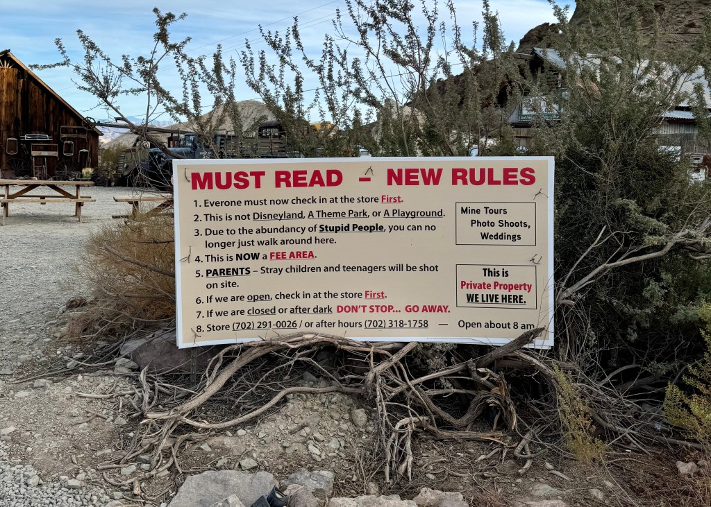
Our final stop before heading back to Las Vegas was to visit the ghost town of Nelson. Justin is fascinated by ghost towns, and we had originally hoped there would be time to visit Calico on our way to Las Vegas, but it was removed from our plans early on, as it was too far out of the way. However, Justin did not let this stop him – he just found a different ghost town to visit.
I have been to a couple other ghost towns previously – one was in Jerome in Arizona, which is actually an active ghost town with businesses in operation. The other is Bankhead near Banff, Alberta, which I would consider to be a true deserted ghost town – all that remains in Bankhead are partial building structures and foundations. Nelson did not appear to be deserted – when we arrived, there was a wedding taking place, another photographer taking pictures of what appeared to be someone’s graduation, a movie being filmed, and even a music video.
My first impression of Nelson was that there were several building structures still in-tact, amongst a sea of old, broken down vehicles – it was a lot of stuff. There is a list of rules that visitors will see upon entrance, with the first rule indicating that visitors must start by checking into the store, where you are required to pay an entrance fee of $1 USD. The other rules are hopefully intended to be tongue-in-check ツ.

While Nelson does offer tours of the abandoned mining town, we arrived too late in the day and had to do our own exploring, instead. While not what I expected, it was still a worthwhile stop!

Our second day of exploring outside Las Vegas was a bit shorter than our previous day (when we were in Death Valley), leaving us a bit of time to explore the Las Vegas strip in the evening. We explored the extravagant hotels and casinos, watched a show at the Bellagio Fountain, and I even tried my luck at slots – somehow I managed not to lose any money, but I also did not win… I started and ended with $10 ツ. We also enjoyed a fun meal at Nacho Daddy – we ordered the Vegan Flaming Chick’n Fajitas, where the server literally lights your food on fire before serving it!
Well, I think that sums up our latest trip to the desert!
Always grateful,
Michelle

The Desert Called, and I Answered… Again (California & Nevada – Part 1 of 2)
After writing several posts about our previous visits to Indio, California, it is starting to become difficult to come up with creative titles for my blogs – how did I do ツ? Subpar blog names aside, our last trip to the desert was in November 2024, and there was definitely no shortage of places to see and things to do during our visit, despite having already spent a lot of time in this area.
We spent the first part of our trip in Indio, before heading to Las Vegas, which provided us with easier access to Death Valley National Park, as well as Grand Canyon West.
Before I get started, a quick note for my email subscribers – did you know that when a blog post is emailed to you, you can click on the title, and you will get redirected to read the post on my website? This will allow you to see the cover photo I have set for each blog!
Indio, California
As you probably already know by now, one of our favourite things to do is hike, and during our most recent visit to Indio, we came across some great new (new to us) hikes to explore:
- Bump and Grind Trail: The Bump and Grind Trail is a very popular trail for hiking, trail running and apparently mountain biking (although, we did not see any mountain bikes during our visit) located right near the city in Palm Dessert. About halfway through the loop, there is a “detour” that takes you to the highest point on the trail. If the gates are open, we would definitely recommend completing this additional portion of the hike – it provides beautiful views of the city and desert landscape. We also noticed (after-the-fact) that some reviews on AllTrails suggest doing the hike clockwise; however, we missed this detail and did the hike counter-clockwise. This made the downhill portion near the end a bit challenging – the trail was narrow, and there was loose rock and gravel. Learn from our mistake – go clockwise!
- Ladder Canyon and Painted Canyon Trail: This was my favourite hike that we did near Indio! The start of the trail head is around 45-minutes from Indio, and requires driving down a dusty, gravel road. Part way down this road, you will encounter an abandoned trailer – if you see this, you are going the right way! As the name suggests, there are several rickety, old ladders that you will need to climb to navigate your way through the canyon. The recommendations on AllTrails (we paid attention this time ツ) suggest going clockwise to ensure you are going up most of the ladders, rather than down. We would also suggest downloading a map of the trail, as it is very easy to miss the first ladder; and, make sure to download it well in advance, as there is no service on the trail itself – I believe we lost service at the start of the gravel road. What I loved most about this trail was the diversity that it offered – you start by going up several ladders through a narrow slot canyon, before emerging onto a ridge that provides panoramic views of the surrounding desert mountains. After the ridge, you will descend back into the canyon to complete the hike, except the way back is along a much wider path (surrounded by colourful canyon rock), compared to the narrow slot canyon at the start of the hike. There is definitely no shortage of beautiful sights at the Ladder Canyon and Painted Canyon Trail.

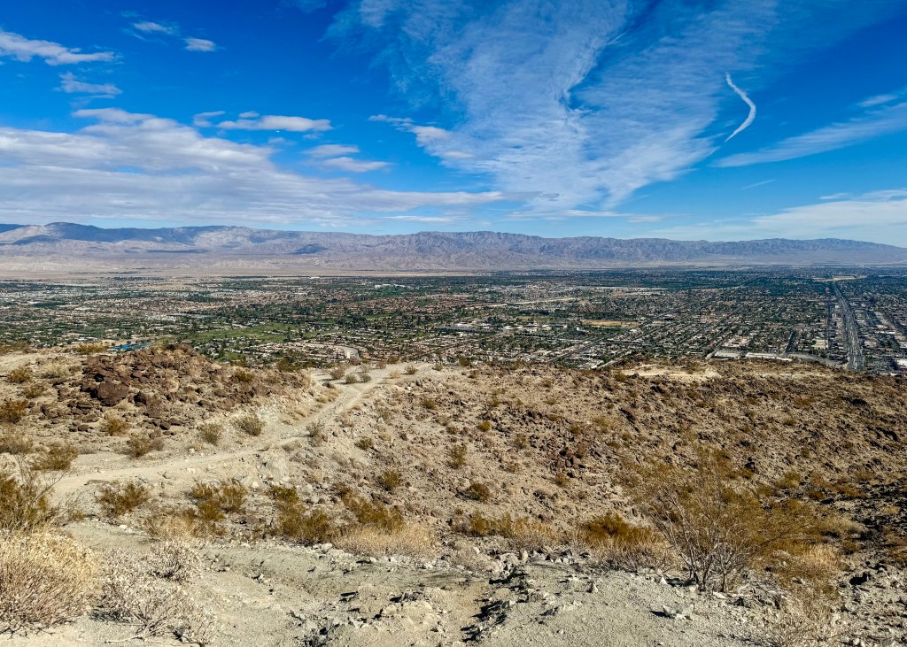
- Pushwalla Palms Loop: The Pushwalla Palms Loop starts off as a flat trail, but you quickly approach a hill that takes you onto a ridge, overlooking multiple different cities within the Palm Desert vicinity. After walking along the ridge (as seen in this blog’s cover photo), you will descend into a grove of palm trees, aka the Pushwalla Palms. This is the only part of the trail where you will find shade, and there was even a small water stream running between the trees. There was also a lot (and I mean a lot) of droppings from desert big horn sheep amongst the Pushwalla Palms. Fortunately, we did not run into a herd of sheep during our hike – you may recall how spooked I was by the big horn sheep that were watching me in Jasper. After walking through the palm trees, you will go up a rock scramble to begin your return to the trailhead. There are two ways to get back – you can either go back along the same ridge you used to reach the Pushwalla Palms, or you can walk below the ridge. We accidentally opted for the latter (we missed the path back onto the ridge), but would definitely recommend taking the ridge back for better views of the surrounding landscape. The Pushwalla Palms Loop was very different from the first two hikes we did, and we very much enjoyed it!
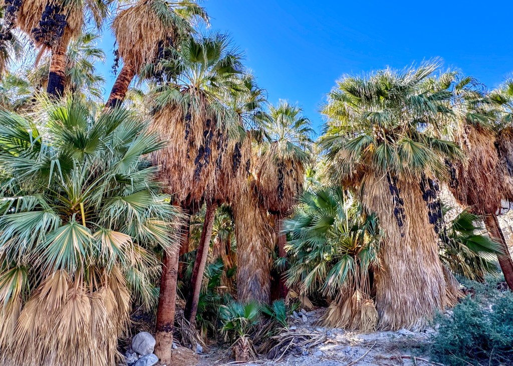
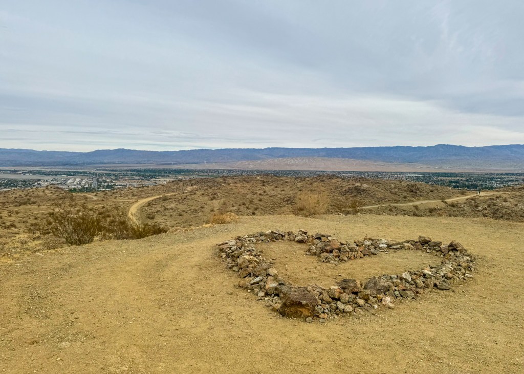
- Jane’s Hoffbrau Oasis Trail: The last hike we completed while staying in Indio was Jane’s Hoffbrau Oasis Trail. The main reason I wanted to do this trail is because the photos on AllTrails showed a heart “structure” made out of rocks that I wanted to see – it was super cute! Similar to the Pushwalla Palms Loop, Jane’s Hoffbrau Oasis Trail also leads you into a grove of palm trees. However, the grove of palm trees at Pushwalla Palms appeared much bigger and healthier than the ones at Jane’s Hoffbrau Oasis Trail. There are so many different trails in this area that you can essentially “build your own adventure” and see where it takes you! If you are looking for a slightly easier trail to do closer to the city centre, then this one is a great option.
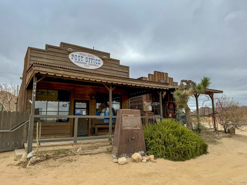
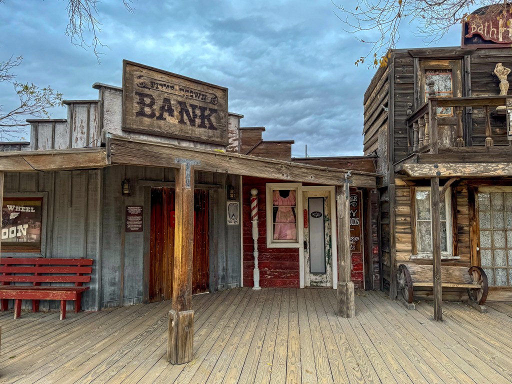
Other than our hikes, we made a quick visit to Pioneertown, an old western-style town that was previously used as a movie set. It is located around an hour from Indio, and is very close to Joshua Tree National Park. There are several shops you can visit along the main strip in Pioneertown, you can grab a drink at the historic Red Dog Salon, and visit the Film Museum, which displays posters of all the movies and TV shows that were filmed in Pioneertown.
Lastly, we made multiple visits to Chef Tanya’s Kitchen while exploring the desert. We enjoyed trying multiple different plant-based sandwiches (my favourite was the Chupacabra Chick’n), soup and ice cream – we cannot believe we did not know about this restaurant sooner!
The Road to Las Vegas
The drive from Indio to Las Vegas is supposed to take 4-hours; however, we made a few stops along the way, and it ended up taking us 8-hours. The problem with our timing was that we had tickets to the Vegas Golden Knights game that evening, and while we made it shortly after 7pm, we missed the warm-up and player introductions, which are Justin’s favourite parts. We would have made it on time had we not taken the wrong road through the Mojave Desert, and encountered terrible traffic on highway-15 due to a multi-vehicle accident.
Despite being late for the hockey game, we really enjoyed the stops we made on the way to Las Vegas:
- Amboy Crater: The Amboy Crater is an extinct volcano located along the iconic Route 66 (more about Route 66 below). Apparently, the Amboy Crater last erupted over 10,000 years ago. You can actually hike into the Crater, but unfortunately we did not budget enough time for this (clearly) – we definitely hope to do this hike during a future visit, as the photos I have seen online look incredible! I will not bother sharing the photo I took, as it does not do this amazing sight justice.
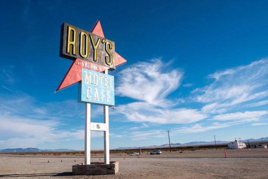
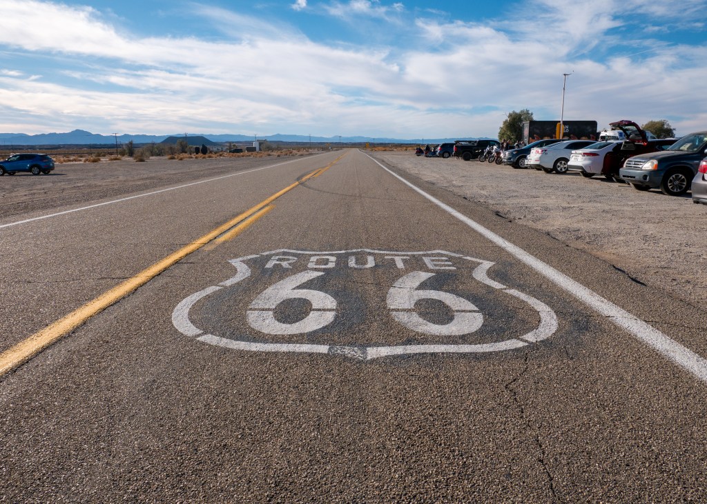
- Roy’s Motel and Cafe: Our next stop, just a couple of minutes further down Route 66, was Roy’s Motel and Cafe. In case you did not know, Route 66, often referred to as the “Main Street of America,” is one of the most well-travelled highways in the United States. It is 3,940km in length, and stretches from Santa Monica, California, all the way to Chicago, Illinois. While no longer in operation, Roy’s Motel and Cafe used to be a popular rest stop for travellers journeying through the desert up until the late 1970s. It just so happened that the day we were passing through (November 30, 2024), was the day Roy’s Motel and Cafe was having its Historic Mural and Monument Reveal event in honour of its 86th anniversary. There were food vendors on site, live music, and a lot of people! While we were not able to stay for the reveal ceremony (in an attempt to make it to the hockey game on time), we really enjoyed this stop! There are a lot of very cool photo opportunities here, as well – there is the neon Roy’s Motel and Cafe sign (which I can imagine looks very cool at night), and the Route 66 sign is painted onto the road in front. We may or may not have attempted to get some jumping photos on the highway with the two signs…
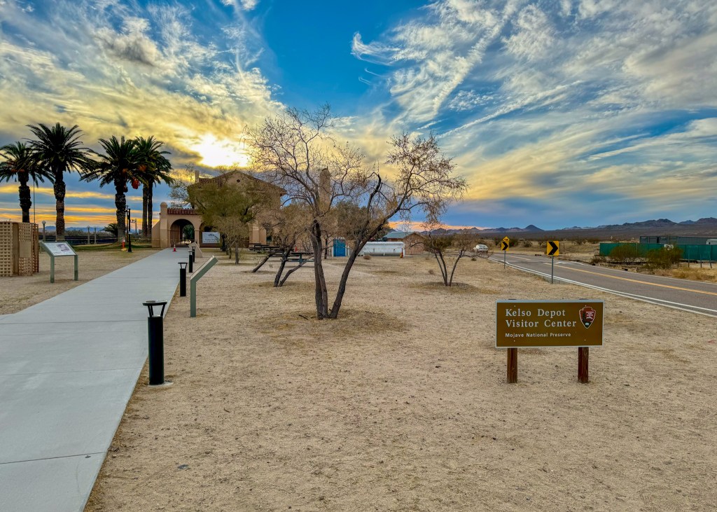
- Mojave National Preserve: One of the faster routes to get to Las Vegas from Indio is actually to cut through the Mojave National Preserve and connect to highway-15. Since this was the recommended route, we decided to make a couple of stops within the protected desert land. Our first stop was at the massive Kelso Dunes. While I have seen sand dunes before (when we visited the Yukon), the Kelso Dunes are massive compared to the small desert in Carcross – the tallest sand dune in Kelso is more than 600 feet tall! For some reason, I find tall mounds of sand deposited amongst other rock formations fascinating, even in the desert ツ.

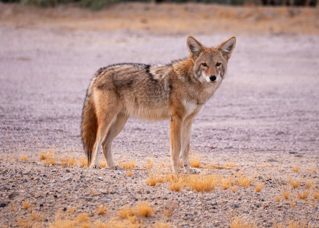
We also stopped at the Kelso Depot Visitor Center. Here, we learned that Kelso used to be a booming mine town following World War II, and we also saw the original Kelso Jail that was used between 1940 and 1985 for housing “drunks and unruly individuals.” There is a lot of history and interesting sights within the Mojave National Preserve – we barely scratched the surface with our quick visit. We also saw some wildlife near the Museum, specifically a roadrunner, and a coyote – is it possible that our favourite Warner Bros. cartoons were inspired by the Mojave Desert? Fortunately for the road runner, Wile E. Coyote was on his best behaviour ツ. My distraction and determination to take a photo of the coyote is ultimately what resulted in us taking the wrong road when leaving the Kelso Depot Visitor Center. Instead of taking the Kelso Cima Road, we ended up on Kelbaker Road, adding several kilometres to our journey, and this did not allow us to skip the accident on highway-15.
Well, I originally planned to also write about our adventures through Death Valley National Park and our stops in Nevada – but since this blog is longer than anticipated already, I will report on the rest of our trip in a separate post ツ.
Always grateful,
Michelle

Local Hikes of 2024
Well, it is that time of year again, where I do a recap of all the local hikes we did in 2024! As a reminder, “local” means the start of the trailhead is within a 2-hour drive from home.
A quick note that all my references to trail length and elevation are from the AllTrails app, cross-referenced with the statistics from my Apple Watch. If you do not already have the AllTrails app, I would definitely recommend downloading it, as it is great for discovering trails in areas you are visiting, and you can download offline maps to use when you do not have cell service.
Make sure to also check out my Local Hikes of 2022 and Local Hikes of 2023 blog posts for more hiking inspiration!
Lindeman Lake Trail, Chilliwack – July 2024
When we were deciding what trail to do, we settled on the Lindeman Lake Trail due to its length and tree coverage. The day we had picked for this hike was expected to be quite warm (over 30°C), and we had 3 dogs with us, which is why we were looking for a short trail that offered shade. We started the hike at 8am (which meant I had to get up at 5am… ouch!), and we were done around 10am in order to beat the heat. I would definitely recommend starting the hike at this hour or earlier, regardless of the weather, as the trailhead parking is small and fills up quickly.
This out-and-back trail is 3.4km round trip, and I would classify it as moderately difficult due to the large rocks and tree roots you have to navigate at the start (and end) of the trail. Overall, we really enjoyed this hike – Lindeman Lake is stunning, and it offers a fun and relaxing atmosphere with many people camping in the forest along the trail, and swimming and paddle boarding on the Lake.
Cheam Peak, Chilliwack – August 2024
Cheam Peak has been on my bucket list of hikes for several years now. However, the road to get to the trailhead is only accessible with a 4×4 vehicle, which we do not have, and when we tried to coordinate going in the past, the dates we had picked were impacted by wildfire smoke.
But, 2024 was the year we were finally able to do this amazing hike, and we owe a big thank you to our friends Josh and Jess for driving us! While Google Maps will tell you that the road up the mountain to the trailhead is only 30 minutes, it is actually closer to an hour, as you have to drive very slowly and carefully through the cross ditches – hang on tight!
Cheam Peak is an 8.7km out-and-back trail, and has an elevation gain of 679m. Fortunately, the switchbacks make the elevation gain more tolerable, but there is very little shade along this trail – it is definitely recommended to start early. An early start has other benefits, as well – parking is a premium at the trailhead, and as the temperature increased during our hike, so did the bugs!
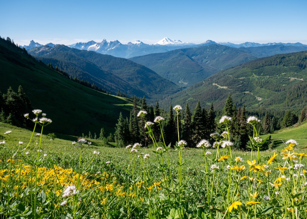
Overall, Cheam Peak is probably the nicest hike I have ever done – you are surrounded by wildflowers, beautiful meadows, and views of Mount Baker for the entire duration of the trail. Once you reach the top, you are rewarded with 360° views of the Fraser Valley – on a clear day, you can see Chilliwack, Harrison Lake, the Fraser River, Cultus Lake and more. It was also very cool to see people paragliding near the peak. This trail is a must see!
Grouse Grind Trail, Vancouver (Grouse Mountain) – August 2024
The Grouse Grind Trail, otherwise known as Mother Nature’s Stair Master, is likely not the most enjoyable hike, but it is definitely a trail you should attempt at least once. It is a one-way trail that is 2.5km in length, and has an 800m elevation gain. Hikers cannot go down the Grouse Grind Trail – they must purchase a gondola pass to return to the parking lot.
I have done the Ground Grind a handful of times in the past, but this was my most successful attempt with a time of 46-minutes and 11 seconds. Somehow, I found the energy to sprint up the last rock scramble, beating Justin by at least 3 seconds – I will make sure he does not forget it, too ツ.
While there are no views along the trail, I feel the views of Vancouver at the top are definitely more rewarding if you hike to them rather than taking the gondola (although I realize this is not an option for everyone). There are many activities you can do at the top of Grouse Mountain such as visiting the Chalet, seeing the Lumberjack Show, and seeing the Refuge for Endangered Wildlife. Following our hike, we paid a quick visit to the wildlife refuge to see the Grizzly Bears, Grinder and Coola, before heading back down the Mountain.

Saint Mark’s Summit, West Vancouver (Cypress Mountain) – August 2024
Saint Mark’s Summit is a 10km hike located on Cypress Mountain in West Vancouver. While we picked an overcast day to do this hike, but were hoping that with a later start (10am), the weather would clear up; however, our views at the top were completely cloud covered – we were very disappointed!
I would consider the hike, itself, to be more challenging due to the length, elevation gain (567m) and the exposed roots along the trail. I would strongly recommend hiking poles if you have them, especially on the way down – we witnessed a couple of bad falls. This hike was also very busy – similar to the other hikes, definitely try to get an early start, and try to go on a clear day!
Teapot Hill, Chilliwack – August 2024
As the name suggests, there are actual teacups and teapots hidden throughout the entire Teapot Hill Trail, making for a fun scavenger hunt throughout the hike! Overall, this is a fairly easy to moderate out-and-back trail (under 5km in length, and 255m in elevation gain) with views of the Fraser Valley at the end. We decided to do this hike last minute after a rain storm – it made for a leisurely afternoon stroll, since it only took us 1.5-hours to complete.

Norvan Falls, North Vancouver – September 2024
Similar to Cheam Peak, we have been talking about doing the Norvan Falls trail for the last couple of years – 2024 was the year we finally checked it off the list!
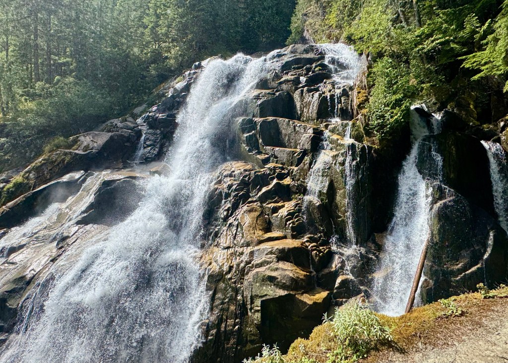
While Norvan Falls is rated as moderate on AllTrails, what made it challenging was the length – it is 14km long and took us around 3.5-hours to complete. This was a great hike for us to do on a warmer day, as the trail offers generous shade and tree coverage. We enjoyed walking amongst the luscious greenery and along the Lynn Valley Creek before getting to the major attraction – the 30m waterfall at the end. The waterfall area is a great spot to enjoy lunch or a snack, and to take a break before getting back on the trail.

Eagle Bluffs via Black Mountain Trail, West Vancouver (Cypress Mountain) – September 2024
If you have been following my blog over the last couple of years, you will know that we have previously completed the Eagle Bluffs Trail – this was actually my third time doing the hike. However, it was a great reminder of just how beautiful this hike is – it has multiple viewpoints along the way, passes many small lakes, and provides stunning views of West Vancouver at the end.
In case you need the reminder, this trail is just under 8km long and has an elevation gain of 437m. Most of the incline is at the start of the trail, which means you get the hard part out of the way early, and can enjoy the rest of the hike. With that being said, I would definitely recommend bringing hiking poles for this trail – they are especially helpful on the way back, as the steep incline contains loose rock and gravel, and can be quite slippery.

Jack’s Trail, Four Lake’s Trail and 50 Shades of Green Trail, Squamish – September 2024
Back in September, my friend Jeanette took us on an adventure through a network of trails in Squamish. We completed an 11km loop in 2.5-hours that touched three different trails: Jack’s Trail, Four Lake’s Trail and the 50 Shades of Green Trail. We passed multiple lakes on this trail, one of which was Alice Lake – another location I have been wanting to visit. Overall, we very much enjoyed exploring these multiple trails in Squamish.
Nairn Falls Trail, Pemberton – October 2024
Last but not least for our 2024 hikes was the Nairn Falls Trail. This Trail is technically 2.5-hours away from home, but I wanted to make sure it was included in this list! We had planned a day trip to Pemberton that day, as one of our favourite restaurants (The HWY. Cafe) was closing down, and we wanted to fit in one last visit. On our way back, we made an impromptu stop at Nairn Falls to complete this short, scenic trail. You will walk along the Green River for a little under 1.5km (one way) before reaching the waterfall. The entire hike takes under an hour to complete, making it easy to fit into your itinerary when visiting the Pemberton area.

Well, I think that covers all the hiking we did in 2024! I hope everyone had a wonderful holiday season, and I want to wish you all the best in 2025! Thank you so much for continuing to support my blog this year, and I hope you will enjoy reading the blog posts I have planned for 2025!
Always grateful,
Michelle

A Quick Tour of Southern Poland
Back in September, I had the opportunity to travel to Southern Poland to visit my relatives. While the trip was focused on much needed family time, I was still able to fit in some sightseeing, which is summarized for you below ツ!
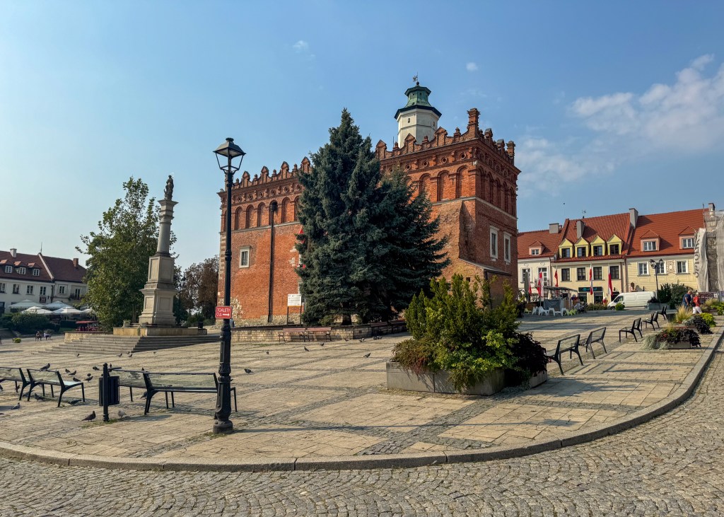
Sandomierz
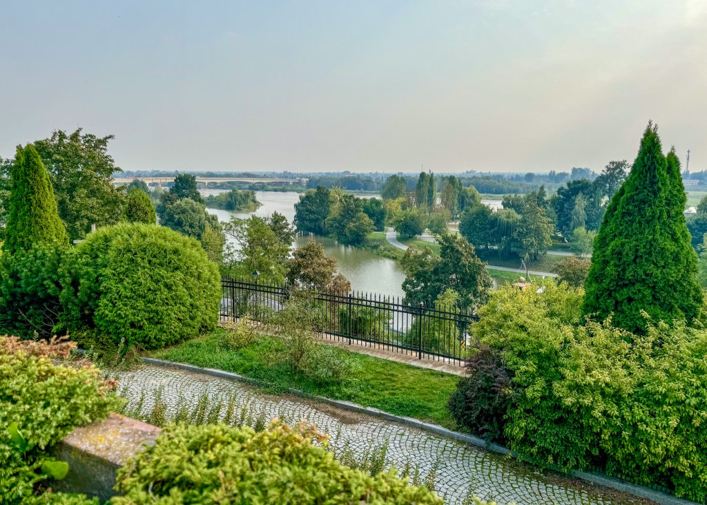
The first city I was able to see during my travels was Sandomierz, a historic town located near the Vistula River (Wisła, in Polish), which is the largest river that flows through Poland. Sandomierz is very important to Poland’s history, as it was home to Polish royalty, was heavily involved in trading with other major Polish cities along the River, and was also forced to rebuild after being involved in many wars.
We started our visit in Sandomierz by entering through the main entrance at the Opatów Gate (Brama Opatowska). Back in the 14th century, Sandomierz was enclosed by brick walls (part of its defence system), and you could only access the town through one of its four gates, only one of which remains today – the Opatów Gate. I learned after-the-fact (once I was back in Canada) that you can actually go to the top of the Gate and enjoy panoramic views of Sandomierz and the Vistula River!
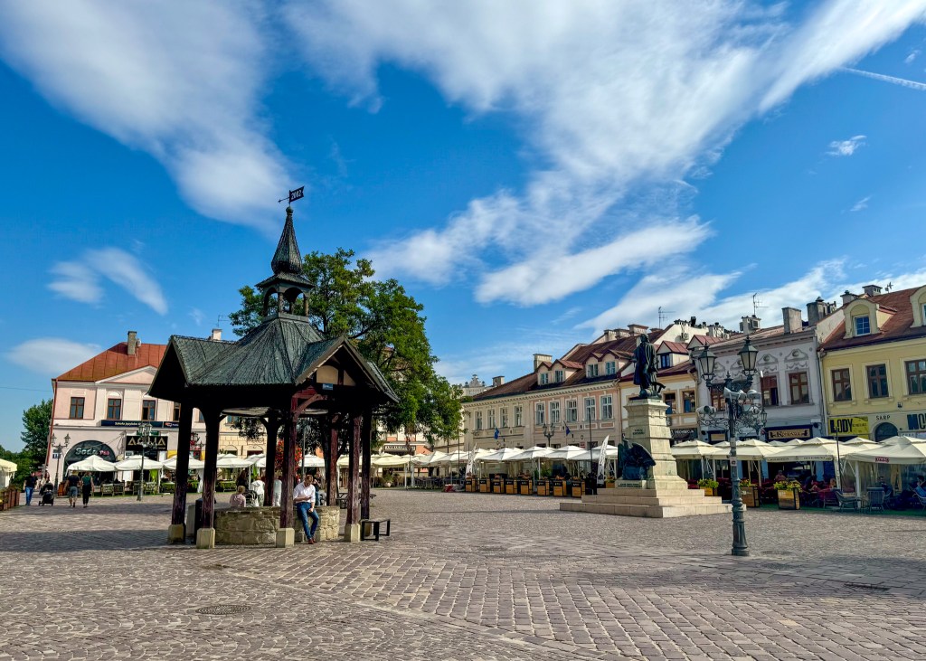
After walking through the Opatów Gate, you will pass several shops before arriving in the Market Square. The Market Square, or Rynek in Polish, was bustling with tourists and buskers, my favourite being the gentleman playing the accordion. The rynek is surrounded by souvenir stores, restaurants and tour vehicles, and at the centre you will find the historic City Hall and clock tower. While taking in my surroundings, I noticed several people sketching the building, which was not surprising as the Structure is supposedly one of the nicest city halls in Poland.
There are many other stunning architectural structures to see in Sandomierz. We went inside the Sandomierz Cathedral, the Sandomierz Castle (which is now a museum filled with archeological exhibits, art, history and more) and walked through the Needle’s Eye (Ucho Igielne), which is a very narrow passage into the town. One of the tour guides we met informed us about an old myth related to the Needle’s Eye: apparently, if you have been a “bad” person, or have a guilty conscience, the passage will close on you when you try to pass through – scary!
Other than these structures, I would definitely recommend taking a walk by the Vistula River, and having a meal in Sandomierz. I enjoyed a plant-based gnocchi meal at Widnokrąg, which is located right by the Opatów Gate – it was delicious!
Rzeszów
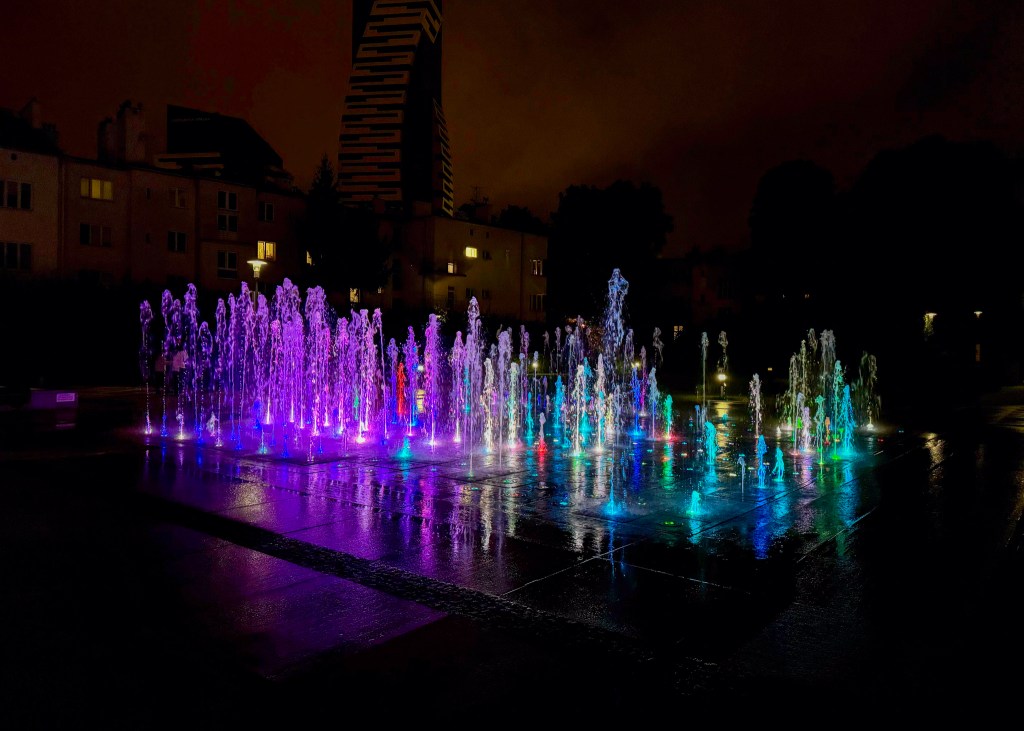
Rzeszów was the next city we were able to visit. While it does not contain the same amount of history as Sandomierz or Kraków (another city I visited – discussed later in this post), Rzeszów is one of the largest and fastest developing cities in Southern Poland. Our main purpose for visiting Rzeszów was for shopping – their rynek is filled with clothing and jewelry shops, as well as various restaurants. We definitely indulged in ice cream, fries (served in a paper cone, which reminded me of my time in Amsterdam), and my favourite was the freshly baked pretzels. The market square also contains a beautiful church (there is definitely no shortage of churches in Poland) and water fountain, both of which were worthy stops during our visit.
Other than the market square, we also explored the major malls in Rzeszów and stopped for lunch at Zielona Baza, which was a fully plant-based restaurant serving burgers, salads and wraps.
Łańcut
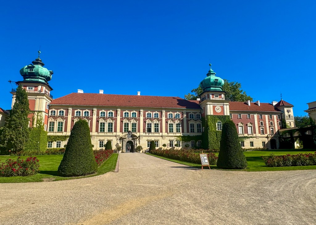
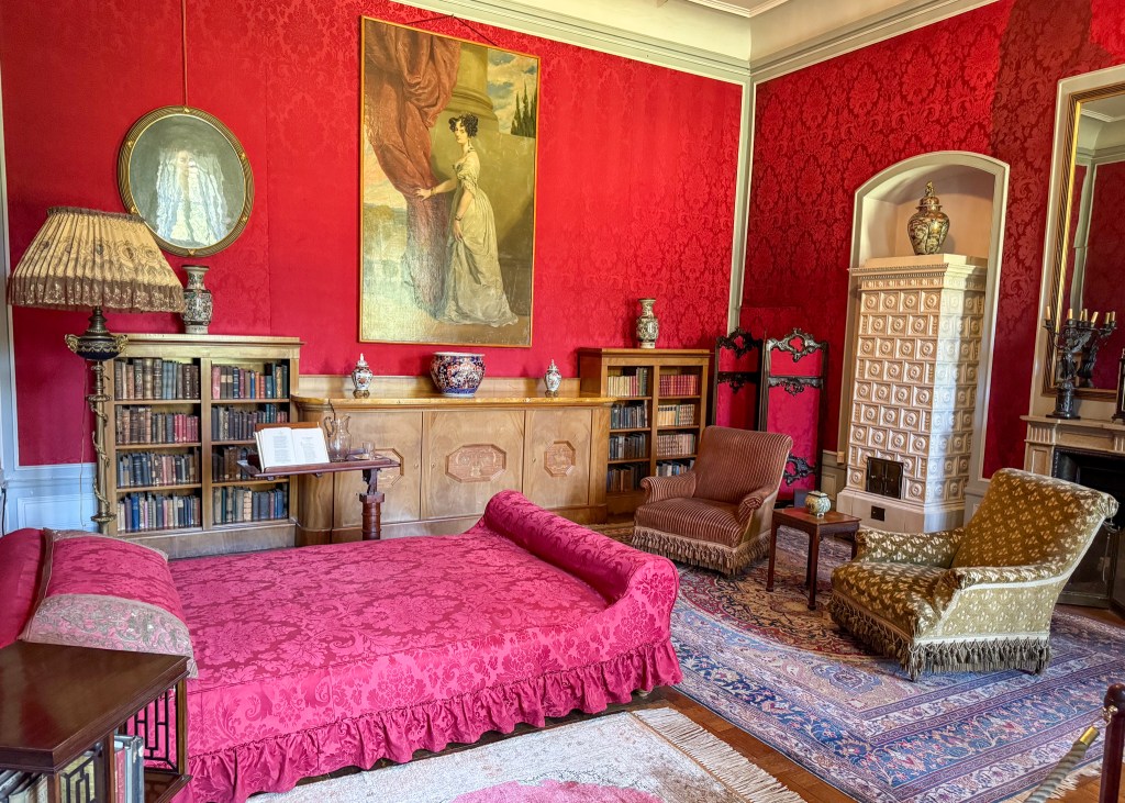
We made a quick visit to Łańcut one afternoon in order to see the Łańcut Castle. We completed a tour of the first floor of the castle, which once upon a time, was home to several royal Polish families. The tour takes you through various living spaces such as the private bedroom chambers, ballroom and dining rooms. Our tickets also included a tour of the Stables and Coach House, where you are able to see a collection of horse carriages that were used during the 18th and 19th centuries. After we were done with the tour, we made sure to walk the Castle grounds to take in the beautiful gardens and landscaping.
Zakopane
Next on the list was a mandatory visit to Zakopane, a small resort town located in the Tatra Mountains (Tatry) near the Slovakia border. I often describe Zakopane as the Whistler of Poland – it is surrounded by beautiful mountain views, and there is no shortage of things to do, regardless of the season. Many visitors enjoy hiking during the summer, skiing during the winter, and you can explore the shops and restaurants along Krupówki Street (the main “strip”) at any time during the year.
Since we only had half a day to explore Zakopane, we prioritized walking down Krupówki Street, where I purchased several souvenirs and gifts for family and friends, and made a quick visit to the Sanktuarium Najświętszej Rodziny church.
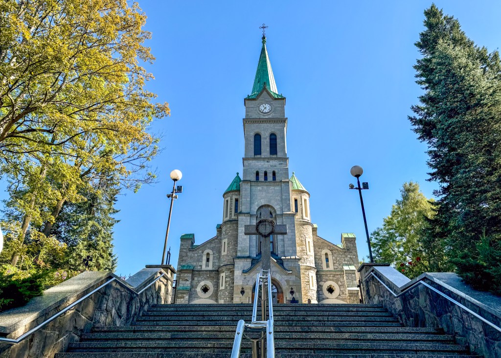
Not too far from Krupówki Street was one of my favourite attractions – the Upside Down House. As the name suggests, the house is literally upside down – you will walk on the “floor,” which is actually the ceiling, and all the furniture and fixtures (e.g., chairs, fireplace) will be on the “ceiling” above you, which is actually the floor. To make things more difficult to navigate, the house is on a slant!

Following our visit to the Upside Down House was a walk along Gubałówka Mountain to take in the views of Zakopane and the Tatra Mountains. Visitors can take the chairlift up to Gubałówka, but we opted to drive and walk. There are several shops and restaurants along Gubałówka (just like Krupówki Street), a chapel, and we were even lucky enough to witness a Góralski Wedding. Górale are the ethnic group that live in the Zakopane region, and their traditional clothing consists of several bright colours and floral patterns, which were evident in their wedding attire!
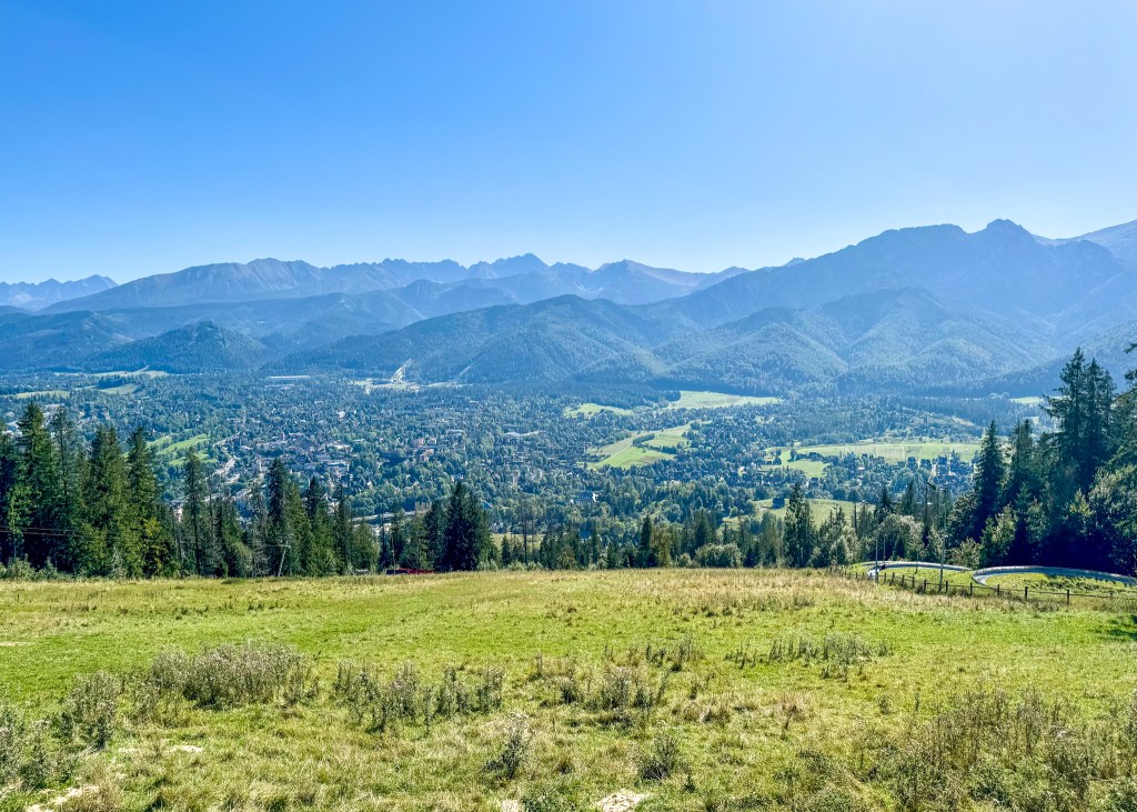
The final two stops we made in Zakopane were to see the famous ski jumps, as well as the large Zakopane welcome sign. For food, we enjoyed a vegetarian pizza (with plant-based cheese) at Pizzeria Pinokio.
Wadowice
The primary reason we wanted to visit Wadowice was to go to the John Paul II Family Home Museum. The late Pope John Paul II was born in Wadowice, and his family home from when he was younger has been turned into a popular tourist attraction. Visitors can learn about the Pope’s youth, his family, and the years he spent as head of the Catholic Church, as well as observe various displays of his clothing and other possessions. Visitors can also walk through the actual rooms that made up the Pope’s family home – the furniture and design of the space have been recreated to authentically reflect the home’s original state. I will admit that I do not usually enjoy visiting museums (you can ask Justin), but I really appreciated the John Paul II Family Home.
Other than the museum, we also attended a mass in the basilica next door before heading to our next destination – Kraków.
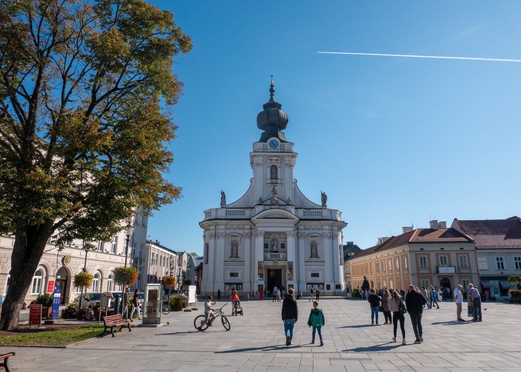
Kraków
Kraków is probably one of the better known cities in Poland, as it used to be the capital of the Country. There is a lot of history in Kraków (including an invasion by Germany in World War II), which means there are many historic buildings, churches and castles to visit. Because we only had a short afternoon to explore the City, we prioritized visiting the Wawel Royal Castle, which was home to many Polish kings and queens for a number of centuries.
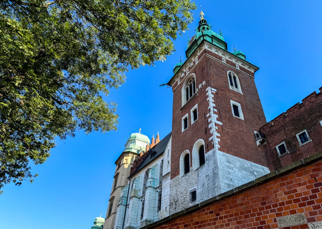
Next, we explored the rynek (you must be very familiar with this word by now), which similar to other Polish cities, was surrounded by souvenir stores and eating establishments. Further, if you have an appreciation for European church architecture, there are multiple churches to see in Krakow (the cover photo for this blog was from the inside of a Polish church). One activity I wish we had time for was to do a boat cruise down the Vistula River, which also passes through Kraków. At least we were able to find a spot by the river to watch the sunset ツ.

Further, I was excited to see that Kraków has many plant-based options and restaurants, but given our limited time, we could only pick one to try – we opted for No Bones Vegan Food. I very much enjoyed my salad with “chick’n” (it appears to have been a seasonal option that is no longer on the menu), and later indulged in a slice of their delicious sponge cake. I will note that the entrance to the restaurant is a bit unexpected – somewhat of a dark tunnel – but keep going, the food was worth it!
Wieliczka
Our last stop in Southern Poland was the small town of Wieliczka, as we were very interested in visiting the Wieliczka Salt Mine. Our visit to the salt mine was probably my favourite part of the trip – I would strongly recommend booking a tour and heading 130 metres underground to experience the tunnels and sculptures that are made of salt!
In terms of preparing for a visit to the salt mine, you should be aware that you will begin your descent underground by going down an 800-step winding stair case – make sure to bring your walking shoes! You might also be thinking about whether you need to take the stairs back up, but I am happy to report there are elevator lifts to assist with your exit ツ. I also found that there was a bit of a draft in the underground tunnels – I would recommend bringing a sweater or light jacket, just in case!
Your tour guide will take you through a series of tunnels, educating visitors on how to mine for salt, as well as providing some Polish history. Not only will you encounter several salt sculptures during the tour, you will actually get to experience an entire underground chapel that is constructed from salt – apparently, it is a popular venue for events such as weddings!
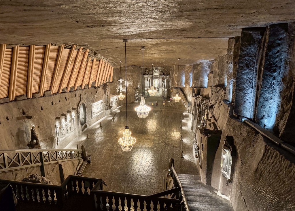
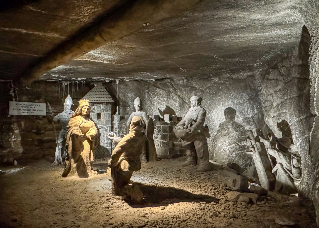
You could likely spend all day underground, as there is also a museum you can visit following the tour, but since you already know my stance on museums, I do not think you will be shocked to hear that I opted to head to the gift shop, instead ツ. The Wieliczka gift shop is probably one of the best I encountered in Poland – there are several very practical purchases you can make here, all of which include salt from the mine – salt (shocking, I know), seasoning for cooking, chocolate, body lotions that include brine, etc.
Once you are back above ground, I would recommend making a quick stop at the Graduation Tower (Tężnia Solankowa) – make sure to include this option when purchasing your tickets. Graduation Towers are used to separate water from saline solutions, enhancing mineral content. Apparently, there are health benefits to being in the presence of the Graduation Tower – the mineral content in the air can help with clearing respiratory issues, and further contribute to a relaxing environment.
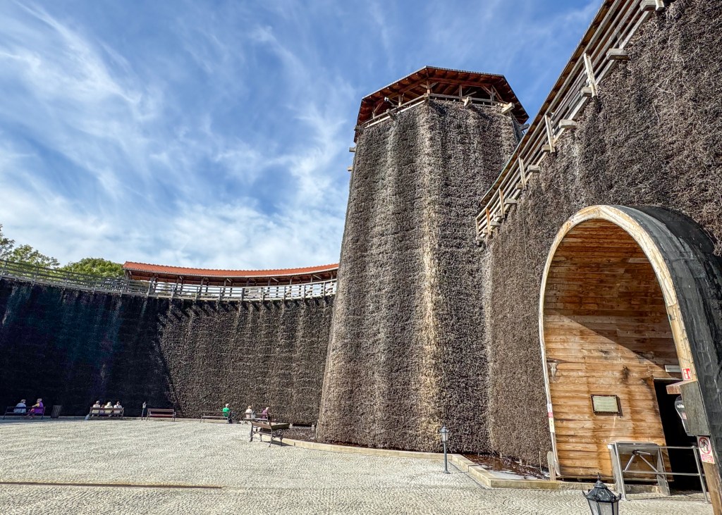
Well, I think that concludes my time in Southern Poland this past fall! During my layover in Frankfurt, I had a brief conversation with another travel, and I said to him that I feel Poland is a very underrated tourist destination. Therefore, the next time you are planning a trip to Europe, I would definitely encourage you to spend some time in Poland. There is no shortage of history, beautiful architecture and different landscapes to see, which I hope I have convinced you of through this blog post ツ.
Always grateful,
Michelle

Welcome to the Jungle – Costa Rica!
Back in March, Justin and I had the chance to spend a week exploring Jaco, Costa Rica, and the surrounding area, and I cannot wait to tell you all about it! But, since we kicked-off our adventure by spending a couple of days in Los Angeles, perhaps I should start there ツ.
Los Angeles (LA), California
As far as I am aware, travellers from Vancouver cannot fly direct to Costa Rica – they either have to connect through a major city in the United States, or through Toronto, Canada. We decided to fly through LA for two reasons: 1) it provided the shortest flight path, and 2) we had never been to LA before and thought it was a good excuse to visit the area!
Since our time in LA was limited, here is a short list of attractions we were able to see:
- Hollywood Sign: In order to see the famous Hollywood Sign, we drove up to the Griffith Observatory, as this is considered a top viewing spot. However, we did not have the best weather during this day – it was raining and overcast for the entire morning and part of the afternoon. For this reason, our first attempt to see the sign in the morning was unsuccessful. We decided to go back to the Griffith Observatory in the afternoon and while the weather had cleared up, it became incredibly busy and we were not able to find parking! Luckily the drive up the hill (as the Griffith Observatory is located on Mount Hollywood) was slow, and I was able to jump out of the car to take photos of the Hollywood sign and the views of LA. But, this meant that Justin was not able to take in the views – sorry, Justin!
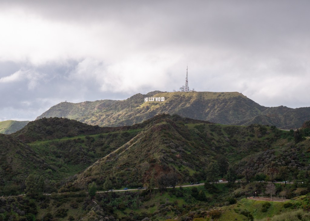
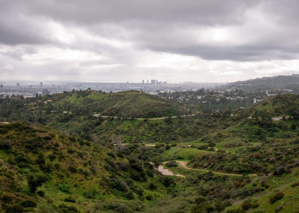
- The Oppenheim Group Real Estate Office: We took a drive down Sunset Boulevard, as I was determined to see the Oppenheim Group Office in real-life! To all the Selling Sunset fans, while the office was closed that day (it was a Saturday) and I did not see any of the cast, I can confirm that the office is as nice as it looks on television! Has anyone ever been near the Office on a weekday? If yes, please tell me what you experienced!
- Rodeo Drive: Think of an expensive, luxurious brand, and you can guarantee that there is a location on Rodeo Drive. We opted not to stop here, but rather drive through and observe stores like Louis Vuitton, Prada and Dior from afar ツ.
- Hollywood Walk of Fame: While our walk amongst the stars was short-lived due to the weather, we were still able to find stars for Michael Jackson, Frank Sinatra and the Beach Boys, to name a few.
- Beaches: As you probably already know, there are tons of beautiful beaches along the California coast. The first beach we visited was Santa Monica State Beach, which includes a small theme park on its Pier, and then we also enjoyed a walk along the Manhattan Beach promenade.

Other than the sights above, we indulged in some local plant-based cuisine – the baked cashew ricotta and pepperoni pizza at Pura Vita West Hollywood, the vanilla and chocolate soft-serve at Bestie’s Paradise, and we also ate at Veggie Grill. LA is quite well known for its diverse plant-based restaurants – we hope to be back in the future to try more delicious food!
Jaco, Costa Rica
The next stop on our trip was to fly to San Jose, Costa Rica! From here, we would drive for 1.5-hours to our final destination – Jaco (pronounced “Haco”). We had a private ride arranged by our hotel from the airport.
It was quite late when we arrived in Jaco, around 10:30pm – we received our keys from security and it was time to get ready for bed!
We spent our first full day in Jaco getting ourselves organized and exploring the town. Our first stop was at Claro to purchase SIM cards for our phones, and then we checked out a couple of different supermarkets to get groceries. Our go-to supermarket (we came here multiple times during our trip) ended up being the Mas X Menos – it had a large selection of produce and packaged food, and also carried other items such as toiletries, sunscreen, etc. making it a convenient one-stop-shop for tourists.
Once we had (mostly) organized ourselves for the week, we went for a beach walk along Jaco Beach and then went back to our hotel to read and swim in the pool. You will notice as you are reading this blog post that this holiday was not like some of our other action packed trips – we actually took some time to relax ツ.
For dinner on our official first night, we went to Karma Cafe & Restaurant and very much enjoyed our experience. We each had a delicious bowl, drink and the best part was carrot cake for dessert!
We were up early the next day to explore Tortuga Island – a “must see” according to the concierge at our hotel. We had to take a 45-minute catamaran boat ride to reach the Island, where we then spent the entire morning and part of the afternoon enjoying its sandy beaches and turquoise blue waters. Our trip to Tortuga included a banana boat ride, a traditional Costa Rican lunch (lots of rice and vegetables – non carne para mi), unlimited margaritas and a short self-guided hike. One of the main reasons we wanted to visit Costa Rica was to experience the wild life, and this small Island had wild pigs, deer and iguanas.
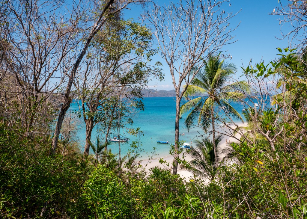
For our third day in Costa Rica, we were off to find the monkeys! Costa Rica is actually home to four species of monkeys (squirrel, white-faced capuchin, howler and spider monkeys) and we were lucky enough to see three of the species on our trip. We signed up for a Mangrove Boat Tour in the city of Quepos (about an hour away from Jaco), which took us along a water channel surrounded by Mangrove trees. We learned during the tour that Mangroves are actually very important to Costa Rica as they provide protection during severe storms.
While we very much enjoyed a relaxing boat ride through the jungle, and were able to see bats and various types of lizards throughout the tour, the most exciting part (obviously) was finding the white-faced capuchin monkeys! The monkeys were very curious and were not afraid to approach the boat or the humans. At the time, we did not know that we would actually see several more monkeys during our trip to Costa Rica, but the boat tour was the closest we were able to get – it was truly incredible!
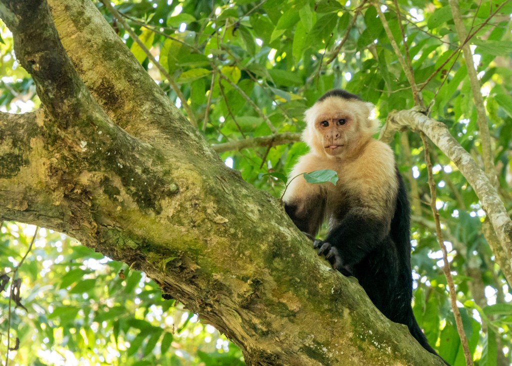
On our way back from the Mangrove Boat Tour, we stopped at the Welcome to Jaco sign for some photos and beautiful scenic views, and at this point, we also saw our first scarlet macaws hanging out in the trees! While at the time I was disappointed we could not get closer to these beautiful birds, it would not be our last time seeing them (this appeared to be a theme for the day).
After an eventful afternoon with the monkeys, we had worked up an appetite and went for dinner at SER Restaurante (another fully plant-based restaurant in Jaco) where we indulged in delicious tacos and a veggie bowl.
For our fourth day in Jaco, we signed up for a tour of Carara National Park. This Park was not actually on our original itinerary, as we were planning to go to Manuel Antonio National Park instead – which is a much more well-known park in the area for experiencing wild life. However, we are very grateful we did not pass up the opportunity to go to Carara National Park!
Our hotel concierge recommended JungleXpeditions for touring Carara National Park, and the owner, Mauricio, was the best tour guide we experienced during our trip. Our visit to the Park was scheduled for the early afternoon, and on our way, Mauricio made a road side stop at a scarlet macaw nest (remember how I said we would see many scarlet macaws on the trip?) – there was a family of these beautiful birds living inside a hole in a tree. Mauricio had a very powerful telescope that allowed us to see the birds up close, and you could even take pictures through the telescope.
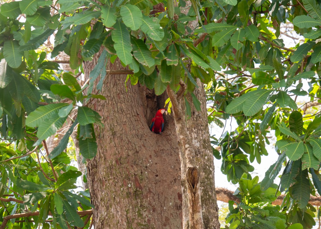
Carara National Park is considered to be a transition forest – where dry and tropical climates collide – making it an excellent area for observing wildlife. You can read more about transition forests here. We were greeted by various types of reptiles at the Park entrance, along with one of my favourites, a two-toed sloth. Other animals we saw at Carara National Park included: howler, spider and white-faced capuchin monkeys (yes, we saw all three!), an owl butterfly, northern ghost bat, more scarlett macaws, an orange-collared manakin, turquoise browed motmot, and a snake – unfortunately, I did not take notes on the specific type.
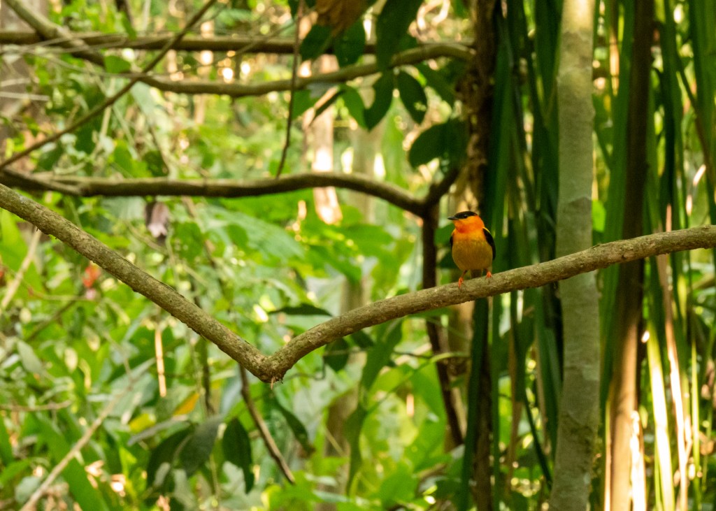
The snake incident was kind of a funny story, actually. Mauricio had suggested Justin and I stand next to a very tall tree for a photo. We started walking towards the tree, Justin a bit ahead of me, and then all of a sudden Justin started screaming and ran back towards Mauricio. He was so shocked he barely got out the word “snake” – Mauricio, myself and the other person on our tour were dying of laughter. As we inspected the snake, Mauricio confirmed it was not poisonous and that it had just eaten – you could see the belly was full. The snake had apparently made eye contact and hissed at Justin, which is why he got spooked! I am sure we will be telling this story for years to come ツ.
While we were absolutely thrilled with our trip to Carara National Park, the one animal we did not see (which was very high on my bucket list for Costa Rica) was a Toucan. Mauricio told me he would try to find a Toucan on our drive back.
Carara National Park is also very close to the Tarcoles River, which is home to approximately 2000 crocodiles. We had originally hoped to go on a crocodile tour (which in hindsight, I am glad did not work out), but instead, Mauricio brought us to the Crocodile Bridge, where we could view these massive creatures from a safe distance ツ.

On our drive back to the hotel, I could tell Mauricio was looking hard for a toucan (I made it very clear how much I wanted to see one). At one point as we were all chatting in the van, he quickly pulled over and said “Michelle, here is your toucan.” We all jumped out of the vehicle – I turned on my camera and Mauricio setup his telescope, and of course in that moment, the toucan flew away. We got back in the vehicle and Mauricio was actually able to follow the toucan. We made another road side stop and started looking, and yes, Mauricio found the toucan… only for history to repeat itself – by the time we got setup, the toucan once again flew away. I was quite disappointed as I did not actually get to see it, but I had not given up hope – I knew there would be more opportunities to find a toucan.
The next day we actually went to visit the other National Park in Costa Rica – Manuel Antonio. This Park is much more popular for tourists than Carara – this was evident, as our tour bus was full! While we were able to see a lot of wild life at this Park, our group size made it difficult to see things through the tour guide’s telescope and we were not able to take pictures on our phone through the telescope. The park was incredibly busy with other groups, as well, which meant we did not see any birds – we definitely did not see a toucan. I much preferred the intimate group size we had for Carara National Park.
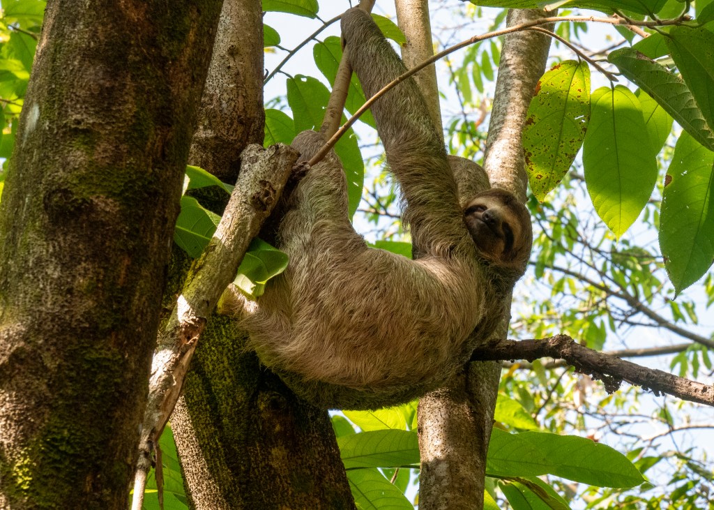
Our trip to Manuel Antonio also included a traditional Costa Rican lunch, as well as some time at the Manuel Antonio beach. On our walk from the beach back to the Park entrance, we saw several white-faced capuchin monkeys as they climbed trees along our path – apparently the monkeys here are not afraid of people, and will even open up your backpack!
For our final day in Jaco, we attended the Chocolate Experience at Vista Los Suenos Adventure Park. During the Chocolate Experience, we learned about where the cacao plant grows (along the “Cacao Belt,” which is near the equator), the different species of cacao trees (23 species, 7 of which are found in Costa Rica), the process by which cacao becomes chocolate, and we even got to make our own chocolate. Costa Rica is actually not a big producer of chocolate – they only produce about 0.7% of the world’s cacao! Costa Rica is much better known for growing coffee; however, we were not able to participate in a coffee tour during our trip.
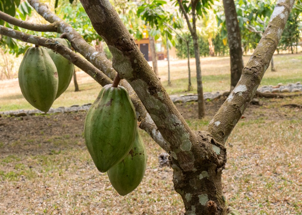
Following the chocolate tour, it was time to head to San Jose for our final night, as we had an early flight to catch in the morning. We actually received a ride from our Carara National Park tour guide, Mauricio, as he also offers airport shuttle services. One other request I had for Mauricio was to find me another toucan ツ.
When Mauricio picked us up, he had mentioned he spoke to some other tour guide friends and was made aware of a toucan nest nearby. As we slowly started making our way down a dusty dirt road, we saw a small bird flying from tree to tree – it was a toucan! We pulled over, got out the telescope and I watched the bird fly back and forth with the biggest smile on my face. It was actually very interesting to watch the toucan fly as it would start to “fall” when it stopped flapping its wings – apparently the toucan’s beak is so heavy it actually has a hard time flying!
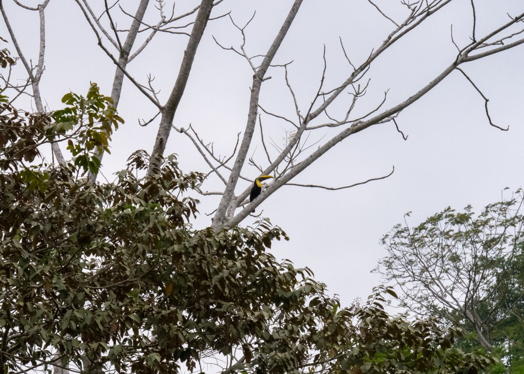
Finally feeling like my time in Costa Rica was complete, we continued onward towards San Jose, making one final stop at Playa Pogeres to take in one final Costa Rican sunset.
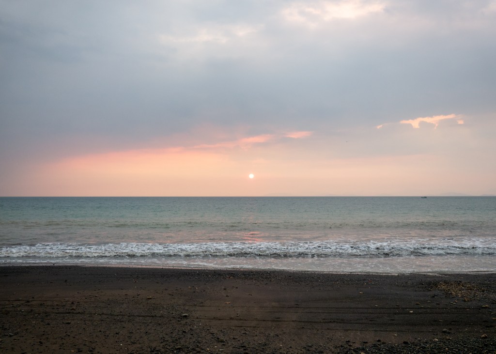
And with that, I will end this blog post. This was definitely a long one – if you are still reading, thank you for being here! I hope you enjoyed reading about our time in Costa Rica and that it will provide you with some ideas on what to do when you visit the area of Jaco!
Always grateful,
Michelle
